
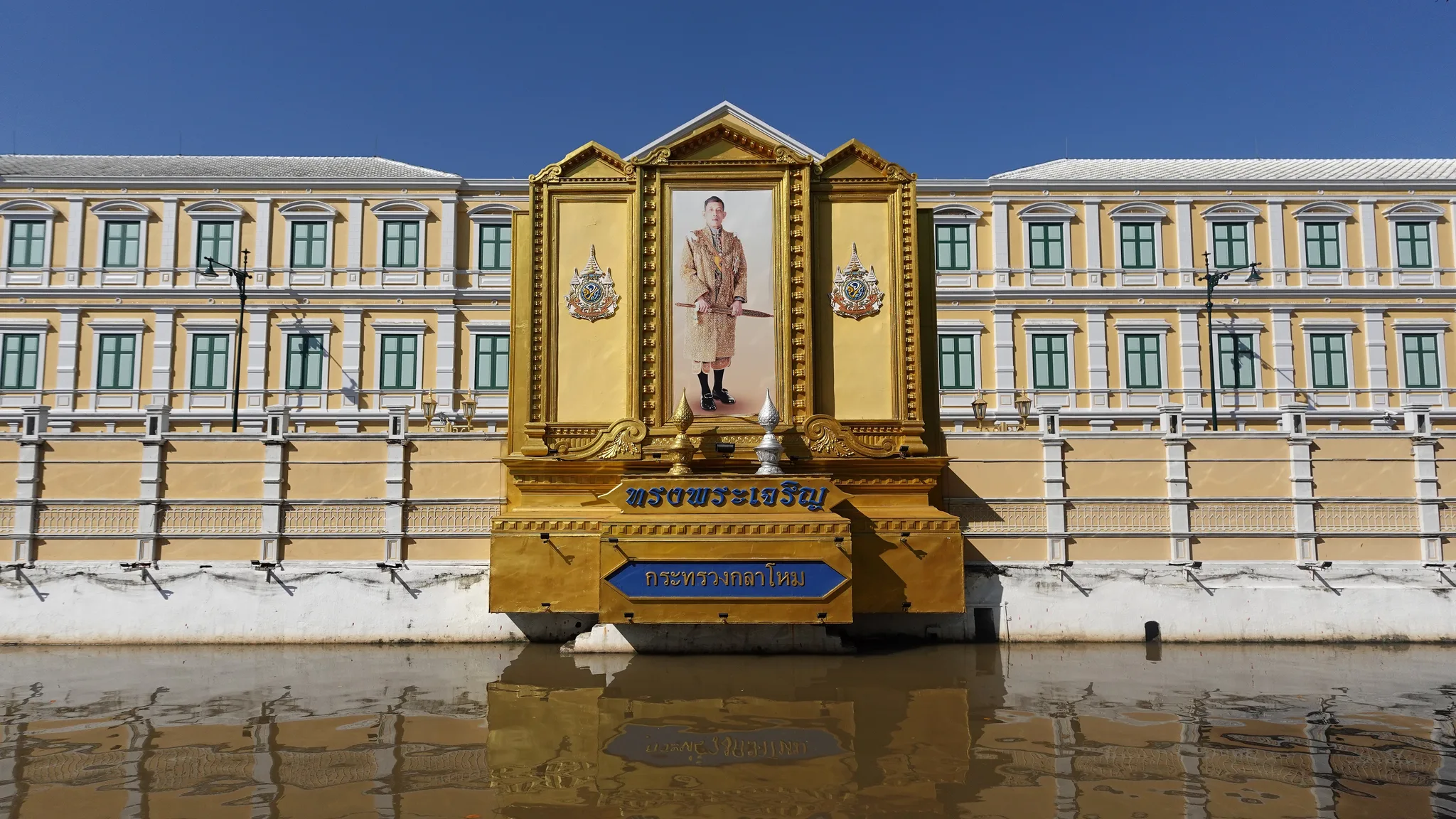
 In Phra Nakhon District, the yellow façade with green windows of the Ministry of Defence, marked by the Thai inscription กระทรวงกลาโหม, rises behind a gilded structure framing a royal portrait, reflected in the water of a canal.© Eric Monteil
Neighbourhood & district
Phra Nakhon District
Bangkok’s central district preserves the layout of the capital founded in 1782 – its palace, its canals and the remains of its ramparts – but also lived-in neighbourhoods whose place in conservation is a matter of debate.
Heritage family · Cities, territories and cultural landscapes
- Destination
- Bangkok (Phra Nakhon)
- Heritage Family
- Cities, territories and cultural landscapes
- Typology
- Neighbourhood & district
- Visit
- Available tours →
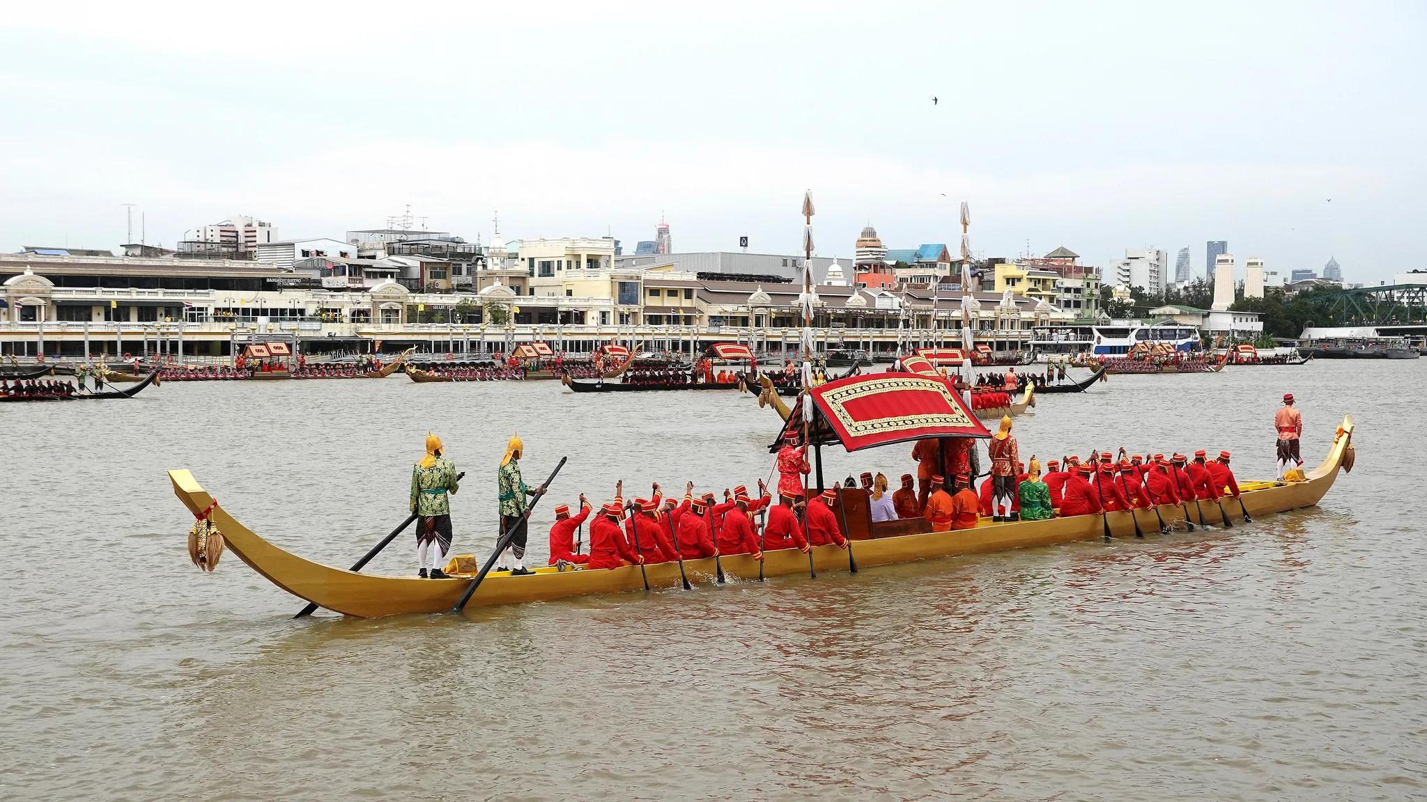
Phra Nakhon District is the central district of Bangkok, on the east bank of the Chao Phraya River. It includes Rattanakosin Island, the heart of the capital founded in 1782 by King Rama I, where the Grand Palace and major Buddhist monasteries stand. First a walled city, then a province, it became a district of the metropolis through successive reforms. It brings together the symbols of the city’s founding and of the monarchy, but also merchant and working-class neighbourhoods. Its canals, its forts and the remains of its city wall still trace the original city, which today lies at the centre of debates over how it should be conserved.13
Key facts
- Destination
- Bangkok
- Heritage Family
- Cities, territories and cultural landscapes
- Typology
- Neighbourhood & district
- Places
- Chao Phraya River
- Khlong Khu Mueang Doem
- Khlong Rop Krung
- Periods
- People
- Rama Ier
- Rama V
- Communities
- Pom Mahakan community
- Events
- Construction of Mahakan Fort
- Construction of Phra Sumen Fort
- Creation of Amphoe Phra Nakhon (1928)
- Founding of Bangkok (1782)
- Foundation of the Grand Palace
- Krung Rattanakosin Conservation and Development Master Plan (1982)
- Heritage
- —
- Glossary
- Khlong
- Prasat
- Ancient monument
- Wat
- Shophouse
- Buddha image
- Keywords
- —
- Date
- —
- Collections
- —
Practical info
Practical information about this site is taken from its Google Maps page. We advise you to check it before visiting.
- Address
- Phra Nakhon, Bangkok 10200
A capital on the east bank
1782: crossing the river
In 1782 King Phutthayotfa Chulalok, known as Rama I, founded a new capital for the kingdom, which took the name of Rattanakosin. He left Thonburi, the capital established on the west bank of the Chao Phraya River, and settled opposite, on the east bank. The city born at that moment is the one whose core Phra Nakhon District preserves today. The present district covers barely more than five square kilometres, and the river still marks its western limit: the administrative boundary continues to follow the bank on which the capital was founded.16
Two places are regarded as the principal symbols of this founding. The Grand Palace houses the royal and ceremonial functions. The City Pillar Shrine (Lak Mueang), which shelters the city’s foundation pillar, marks the centre of Bangkok. Around them rise important Buddhist monasteries, the wat. Some two years after the founding, the Giant Swing (Sao Chingcha) was erected in turn. It gave its name to the tiny sub-district that surrounds it, a sign that these founding monuments still shape the administrative geography of the area.15
An island drawn by canals
The name ‘Rattanakosin Island’ goes back to the founding of the city. The island is not a natural one: it is canals, the khlong, that define it by cutting through the east bank. The first, Khlong Khu Mueang Doem, is the former city moat; it is commonly known as Khlong Lot. Further east, Khlong Rop Krung forms a second belt of water.25
These two canals divide the area into two parts. Between the river and Khlong Khu Mueang Doem lies Inner Rattanakosin, home to the palace and the principal sanctuaries. Between the two canals lies Outer Rattanakosin, initially less built up. This distinction, born of the city’s layout, still serves two centuries later to organise its protection.16
The city wall of Rama I
Rama I surrounded his capital with a wall more than seven kilometres long, punctuated by fourteen forts and pierced by sixty-three gates. To build it, he reused materials taken from Taksin’s old walls, from the ruins of King Narai’s fort and from the fortifications of Ayutthaya. The new wall thus partly reused materials from older fortifications.17
Phra Sumen Fort guards the northern corner, at the mouth of the Bang Lamphu canal. Mahakan Fort holds the eastern side, near Phan Fa Lilat Bridge. These two structures are among the few surviving witnesses to this defensive system.17
From walled city to district
The city moves beyond its walls
In the second half of the 19th century, Bangkok spread beyond its city wall. Most of the walls and forts were then demolished or replaced. By the end of the century, the old core formed, together with the neighbouring districts of Pom Prap Sattru Phai and Samphanthawong, what then constituted the city proper.17
King Chulalongkorn, Rama V, gave this city an administration of its own. In 1906 he created the monthon Krung Thep Phra Maha Nakhon, an administrative circle overseeing the capital. In 1915 this monthon was divided into several provinces. Bangkok thus passed from a royal city defined by its walls to a territory governed through administrative divisions.15
From province to district
On 12 March 1928, six districts were merged to form Amphoe Phra Nakhon, the amphoe being the district in Thai administration. Among them are names still familiar today: Phahurat, Samran Rat, Phra Ratchawang, Chana Songkhram, Sam Yot and Bang Khun Phrom. At the same time there existed a province of Phra Nakhon, covering the whole east bank of Bangkok.13
At the turn of the 1970s, this province merged with that of Thonburi, on the opposite bank, and the Bangkok Metropolitan Administration was created in 1972. The former amphoe then became a khet, a district of the metropolis. Phra Nakhon District is today divided into twelve sub-districts, the khwaeng. Its district office is located in the sub-district of Wat Sam Phraya, at the north-western tip.15
A name with many meanings
These successive reforms explain why the name Phra Nakhon refers to several realities. It is the present district, but also the former province that covered the east bank until its merger with Thonburi. More broadly, the word still designates the whole eastern bank of Bangkok. Finally, it is the Thai name for Angkor, the great Khmer city. The spellings Phra Nakhorn and Phra Nakorn are also found. Reading an older text about Phra Nakhon therefore requires knowing which territory it refers to.30
Reading the royal city
The palace and its open grounds
The western part of Phra Nakhon District belongs to the sub-district of Phra Borom Maha Ratchawang, which bears the name of the Grand Palace. It is the district’s main administrative area, but has few inhabitants. Here the palace opens onto vast public spaces. In front of Saranrom Palace lay the Sanam Chai ground, the ‘field of prosperity’, where military exercises were held and which gave its name to the present-day road. The Sutthaisawan Prasat Hall, one of the halls of the Grand Palace, overlooks this space; the king uses it for his public appearances.28
These open grounds have also served political life. In the 1960s and 1970s, parties often opened their election campaigns at Sanam Luang and closed them at Sanam Chai. These grounds thus became places where voters were addressed. Nearby, the Bangkok National Museum, located in the district, completes this ensemble of royal and cultural sites.22
What remains of the ramparts
Of Rama I’s city wall, only two short sections of wall and one gate survive. They can be seen along Phra Sumen Road and adjoining Mahakan Fort. The Phra Sumen and Mahakan forts, at either end of this north-eastern sector, are the most visible landmarks of the old walled city.17
The number of forts still standing varies according to how they are counted. For Bangkok as a whole, four are recorded: Mahakan, Wichaiprasit, Phra Sumen and Pong Patchamit. If one considers only the forts built under Rama I, just two remain, Mahakan and Phra Sumen. The difference lies in the scope adopted: only two forts still bear witness to the founding city wall.19
Canals, bridges and markets
The canals remain the thread by which the old layout can be read. On Charoen Krung Road, Saphan Mon, the ‘Mon Bridge’, crosses Khlong Khu Mueang Doem. Its name recalls the Mon traders who once moored their floating houses there. The Art Nouveau structure is maintained by the Bangkok Metropolitan Administration and registered as an ancient monument by the Fine Arts Department, the government body responsible for monuments.29
At the southern end of the district, the Wang Burapha Phirom area was known under Rama V as Tambon Pak Khlong Talat, after the great market of the same name. It owes its present name to the Wang Burapha Phirom palace, residence of Prince Bhanurangsi Savangwongse. In the 1950s the palace was demolished; in its place were built a shopping district and three cinemas that took up the name ‘Wang Burapha’.25
Lived-in neighbourhoods
Around Bang Lamphu
The sub-district of Bowon Niwet takes its name from Wat Bowonniwet. It brings together landmarks from very different periods: the Democracy Monument, Wat Ratchanaddaram, Satriwitthaya School and part of the Bang Lamphu neighbourhood. The proximity of great monasteries and a modern political monument shows that the old royal city has continued to receive the symbols of each era.24
The neighbouring sub-district of Talat Yot corresponds to most of Bang Lamphu. Here are Khaosan Road and Rambuttri Road. Khaosan Road is one of the best-known places for Songkran, the water festival, where residents and tourists come together. Phra Nakhon District is therefore not merely an ensemble of monuments: it is also a place of festivity and passage, frequented by very diverse crowds.27
Phra Sumen Road
Phra Sumen Road runs alongside Khlong Rop Krung, from Phra Sumen Fort to Ratchadamnoen Avenue, opposite Mahakan Fort. It thus follows the line of the old city wall, one section of which it retains. The former Kurusapa printing house stands here.18
Its shophouses, the narrow house-and-shop buildings lined up along the street, now host restaurants, cafés, galleries and bookshops. The street shows how an old urban fabric can find new uses without losing its form: the wall, the canal and the façades remain legible, while the activities have changed.18
A shrinking population
Yet the area is losing its inhabitants. At the 2000 census, the district had a little over 90,000 residents; by 2020 there were only around 45,000, according to the civil registration records. The population has thus halved in twenty years, and the decline continues year after year.1
This decline weighs on the very nature of the place. A historic centre can remain very busy while losing those who live there. The question of residents’ place, moreover, runs through the entire recent history of the conservation of Rattanakosin Island.
Conserving the old city
The bicentenary plan
The protection of the area’s monuments began with isolated measures. In 1949 the Fine Arts Department registered the Giant Swing as a national ancient monument. In the 1970s, academics launched the first conservation initiatives in the Rattanakosin area. In 1982, for the city’s bicentenary, the master plan for the conservation and development of Krung Rattanakosin was adopted; many of the island’s monuments were registered on that occasion.3
The 1982 plan protects three historic royal zones of the old city. It divides the territory into three sectors: Inner Rattanakosin, Outer Rattanakosin and the facing Thonburi bank. The island is henceforth a conservation area recognised for its historical importance. Its management falls to the Committee for Rattanakosin Island and the Old Town, chaired by a deputy prime minister. In 2003 this committee extended its remit to the old towns of other provinces.5
Which values to protect?
The 1982 plan drew criticism over what it chose to protect. Natsuko Akagawa, a researcher in urban conservation, shows that it created a disagreement over the assessment of values: several long-established communities were deemed unimportant, and the plan proposed demolishing old shophouses to open up views of the Grand Palace. She argues for ‘integrated conservation’, which involves the various stakeholders.4
Other analyses go further. In their view, conservation was aimed above all at attracting investment and developing tourism, and vernacular housing – that is, ordinary houses built according to local practice – was excluded from the plan. Chatri Prakitnonthakan, who has studied the conservation principles applied to the island, speaks of a ‘Rattanakosin Charter’: an unwritten doctrine that guides the choices of the Fine Arts Department and the list of registered buildings. These readings converge on one point: protecting the old city first meant showcasing its royal and religious monuments.5
Everyday heritage under threat
Buildings that do not fit this official image remain vulnerable. Piyamas Lernapakun, who studies the island’s forgotten heritage, notes that old buildings are being demolished and replaced by concrete structures. The wang, the princely residences, and the shophouses are under threat, including properties belonging to the Crown Property Bureau.6
In the face of these threats, residents have organised themselves. According to Chatri Prakitnonthakan, the island’s communities joined forces in the 2000s to negotiate more effectively with the state; he cites the Mahakan Fort community as an example. Conservation is therefore no longer played out solely between specialists and administrations: those who live in the area are claiming a place in decision-making.2
Phra Nakhon District today
The metro beneath the island
The Bangkok metro has recently reached the old city. The Blue Line serves, among others, Sanam Chai station, dug beneath the road of the same name; it is the only station in Inner Rattanakosin. Its ceiling is higher than in most stations on the line, and, together with Sam Yot, Itsaraphap and Wat Mangkon, it ranks among the four stations with the most striking Thai decoration.20
The construction work also revealed the city’s subsoil. Beneath Exit 1 of Sanam Chai, a museum space displays objects found during the excavation of the station. The Bangkok National Museum organises cultural events in partnership with the metro. Sam Yot station, which serves the sub-districts of Samran Rat and Wang Burapha Phirom, is due to become an interchange with the Purple Line once its extension is complete. Modern transport is thus becoming a new gateway into the historic quarter.12
New plans, new controversies
The planning of the old city remains an open question. A conservation and development plan drafted in 1997 has been revived by the Bangkok Metropolitan Administration, which also plans to move to Din Daeng and convert its former building into a museum. The project for a fourteen-kilometre promenade along the Chao Phraya has been contested, and the Committee for Rattanakosin Island and the Old Town has proposed stopping it outside the old city. Critics have also denounced the quiet revival of a project to turn the old city into a Thai ‘Champs-Élysées’.11
In 2017 the Office of Natural Resources and Environmental Policy and Planning (ONEP), which acts as the committee’s secretariat, commissioned Chula Unisearch, of Chulalongkorn University, to draft a new master plan, extended as far as the Phadung Krung Kasem canal. Yongtanit Pimonsathean, a committee member, explains that it gives priority to communities, buildings and houses of local rather than national value. Pradech Phayakvichien, an expert on the committee, stresses the need to raise residents’ awareness. Heritage identification, conservation standards and overtourism still call for a revision of the plan by 2032 and better cooperation between stakeholders.8
Understanding
Phra Nakhon District is the city that Rama I laid out in 1782: an island bounded by canals, with the palace, the city pillar and the great monasteries at its centre, and merchant quarters on its fringes. Its importance lies in this continuity. The founding plan can still be read in the streets, the canals and the remains of the ramparts, and the places of the monarchy retain their ceremonial role. It is also a district where people live, trade and celebrate. Yet its residents are leaving: their number has halved in twenty years. Conservation, long centred on royal and religious monuments, is now opening up to ordinary houses and communities, while the metro, tourism and major development projects are transforming the ways the area is used. Will the old city remain a lived-in city, or will it become above all the backdrop to national memory?
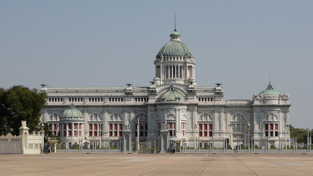
Rattanakosin, from the royal citadel of 1782 to the historic districts that shaped contemporary Bangkok.
- Khlong
- Canal or waterway, natural or man-made, which long played a major role in transport, irrigation and the organisation of settlements and territories in Thailand.
- Prasat
- In Thai architecture, a building or canopy with tiered roofs crowned by a spire, a form reserved for sacred images and for royalty.
- Ancient monument
- In Thailand, a legal category (boran sathan) that places a building or site under State protection as heritage.
- Wat
- Buddhist monastic complex that brings together, within a single enclosure, several religious buildings, monks’ quarters and ancillary buildings; the word does not refer to a single building.
- Shophouse
- A narrow, deep urban house built in a row, whose ground floor serves as a shop and upper floor as living quarters, typical of the trading towns of South-East Asia.
- Buddha image
- In Thai Buddhism, a devotional representation of the Buddha, most often a statue, venerated as an object of worship.
- Khet
- Thai name for the administrative districts of Bangkok, equivalent to the districts of the provinces; each khet is subdivided into khwaeng, or sub-districts.
- Khwaeng
- An administrative subdivision of Bangkok, ranking below the district (khet), the urban equivalent of the tambon in the provinces.
- Tambon
- A Thai administrative subdivision grouping several villages, ranking below the district.
- Songkran
- Traditional Thai New Year, celebrated in mid-April, marked by water-sprinkling rites and merit-making.
- Amphoe
- District, the tier of Thai territorial administration between the province and the subdistrict (tambon); in Bangkok it is replaced by the khet.
- Wang
- Thai word for a palace, particularly the residence of a prince or a member of the royal family.
- Lak Mueang
- Foundation pillar of a Thai city, erected when the city is founded and regarded as the seat of its guardian spirit; it is housed in a dedicated shrine.
- Monthon
- Regional administrative division of Siam grouping several provinces, introduced by the administrative reforms of the late 19th century and abolished in 1933.
Primary sources
- 1Phra Nakhon District (Q1525441), Wikidata (données Department of Provincial Administration et recensements) ↗
Studies
- 2Chatri Prakitnonthakan, Rattanakosin Charter: The Thai Cultural Charter for Conservation, Journal of the Siam Society, vol. 100, 2012 ↗
- 3The Implementation of Conservation Plans of the Rattanakosin Area, Bangkok, Architectural Institute of Japan (communication), 2006 ↗
- 4Natsuko Akagawa, The Current Issues on Urban Conservation in Bangkok, CIB (base ICONDA / IRB) ↗
- 5Gentrification and Heritage Tourism: Spatial Conflicts in Central Bangkok, IAFOR, Asian Conference on the Social Sciences 2014, 2014 ↗
- 6Piyamas Lernapakun, The Forgotten Heritage of the Rattanakosin Area, Journal of Urban Culture Research (ThaiJO) ↗
- 7Master Planning for Conservation and Development of Krung Rattanakosin 2032, ResearchGate ↗
- 8Keep a watch on management of inner Bangkok: Krung Rattanakosin and Chao Phraya Walkway Master Plans, Prachatai English ↗
- 9Plan to preserve old cities rejuvenated, Bangkok Post ↗
- 10Rattanakosin plan poses threat, Bangkok Post ↗
- 11There's a plan to make Bangkok's Old Town great again, but at what cost?, BK Magazine ↗
- 12Journey back through time with Bangkok's MRT, The Nation Thailand ↗
Reference works
- 13Phra Nakhon district, Wikipedia ↗
- 14Phra Nakhon, Encyclopaedia Britannica ↗
- 15Bangkok, Wikipedia ↗
- 16Rattanakosin Island, Wikipedia ↗
- 17Fortifications of Bangkok, Wikipedia ↗
- 18Phra Sumen Road, Wikipedia ↗
- 19Remnants of the Rattanakosin Walls, Atlas Obscura ↗
- 20Sanam Chai MRT station, Wikipedia ↗
- 21Sam Yot MRT station, Wikipedia ↗
- 22Sanam Chai Road, Wikipedia ↗
- 23Sao Chingcha subdistrict, Wikipedia ↗
- 24Bowon Niwet subdistrict, Wikipedia ↗
- 25Wang Burapha Phirom subdistrict, Wikipedia ↗
- 26Wat Sam Phraya subdistrict, Wikipedia ↗
- 27Talat Yot, Wikipedia ↗
- 28Phra Borom Maha Ratchawang subdistrict, Wikipedia ↗
- 29Saphan Mon, Wikipedia ↗
- 30Phra Nakhon (disambiguation), Wikipedia ↗
Further reading
Contemporary views
Phra Nakhon District today
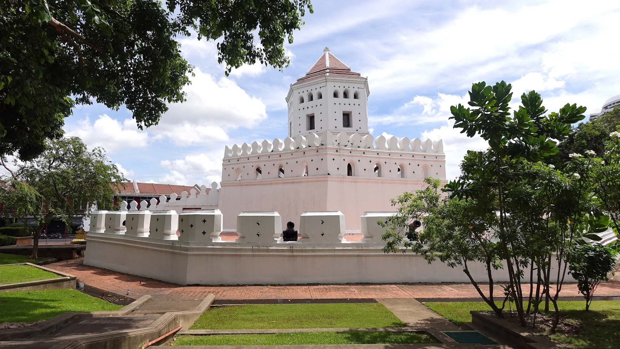
In Phra Nakhon District, Phra Sumen Fort raises its white octagonal tower with a tiled roof above a crenellated rampart with cannons in its embrasures, set within a landscaped garden of lawns and brick paths.© Eric Monteil 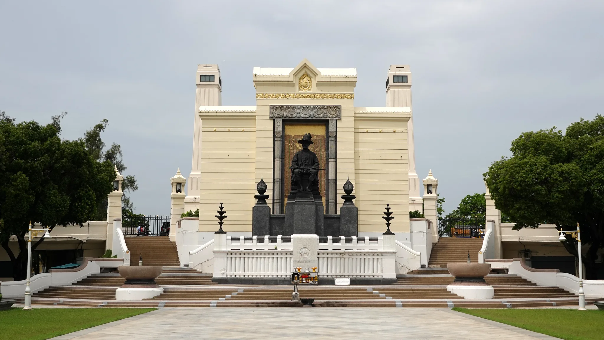
In Phra Nakhon District, the King Rama I monument presents a seated bronze statue before a gilded panel, framed by two towers, symmetrical staircases and a white balustrade preceded by an offering table.© Eric Monteil
Architecture and decoration
Explore the heritage
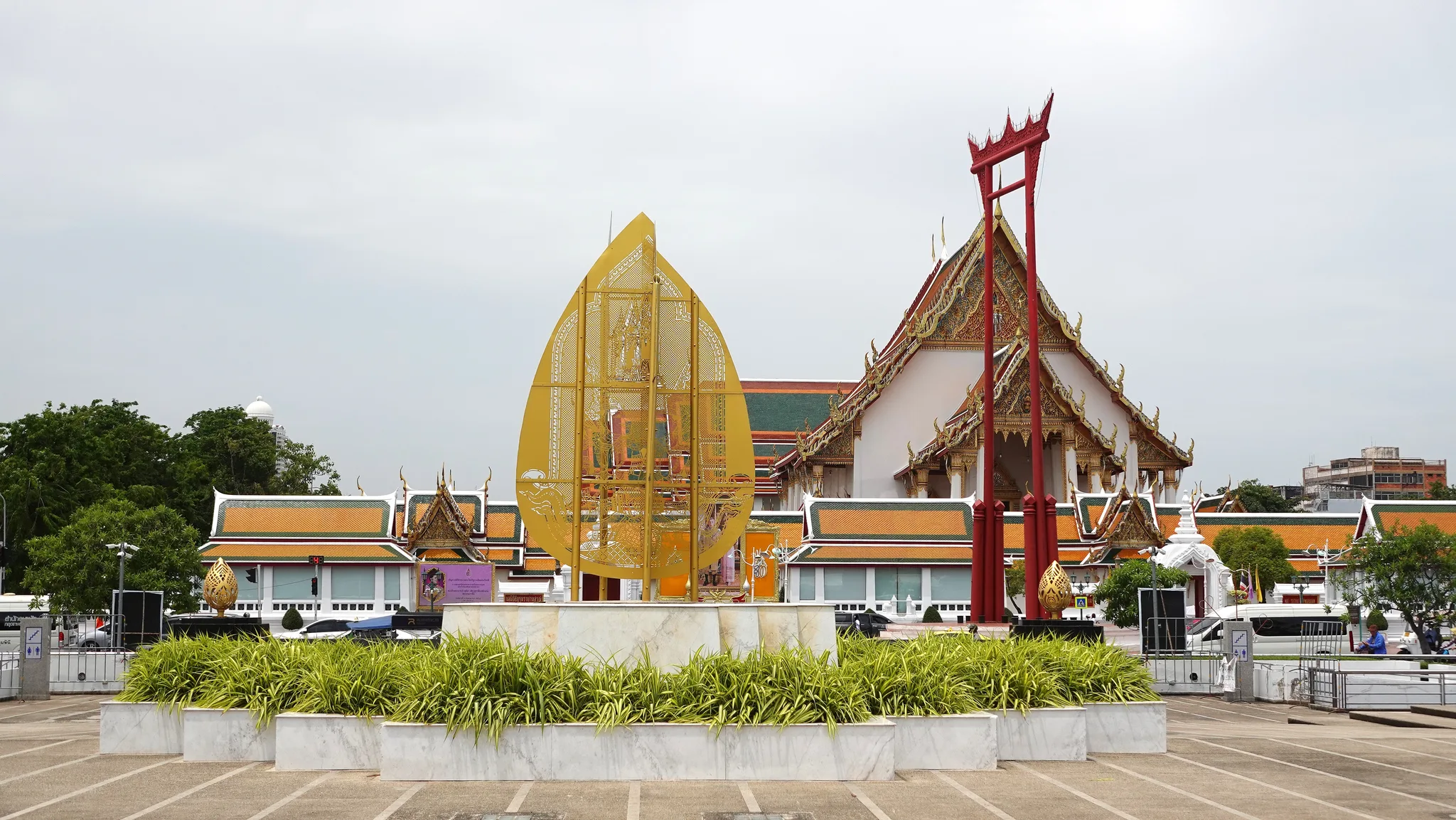
In Phra Nakhon District, the red pillars of the Giant Swing (Sao Chingcha) rise before a viharn with tiered roofs adorned with chofa; in the foreground, a golden leaf-shaped stele stands on a marble base.© Eric Monteil 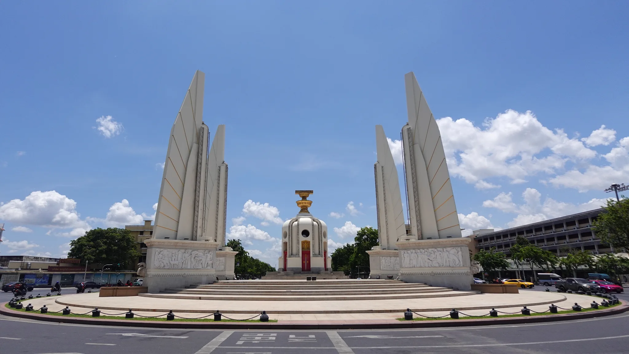
Democracy Monument in Phra Nakhon District: four white wing-shaped pylons with bas-reliefs at their base frame a central turret with red doors topped by a gilded ornament, at the centre of a roundabout.© Eric Monteil
Archive
Memory of time passing
Historical images preserve the visual memory of places and of the ways they have changed.
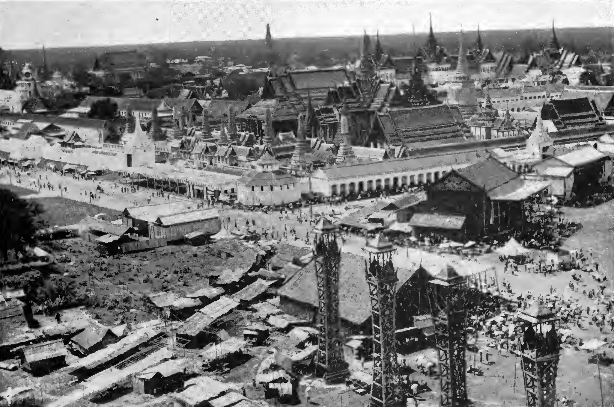
Early elevated view of Phra Nakhon District: a vast, crowded open ground with temporary shelters and lattice towers stretches before a long white wall, above which rise tiered roofs, chedis and spires.Auteur inconnu — Wikimedia Commons, domaine public 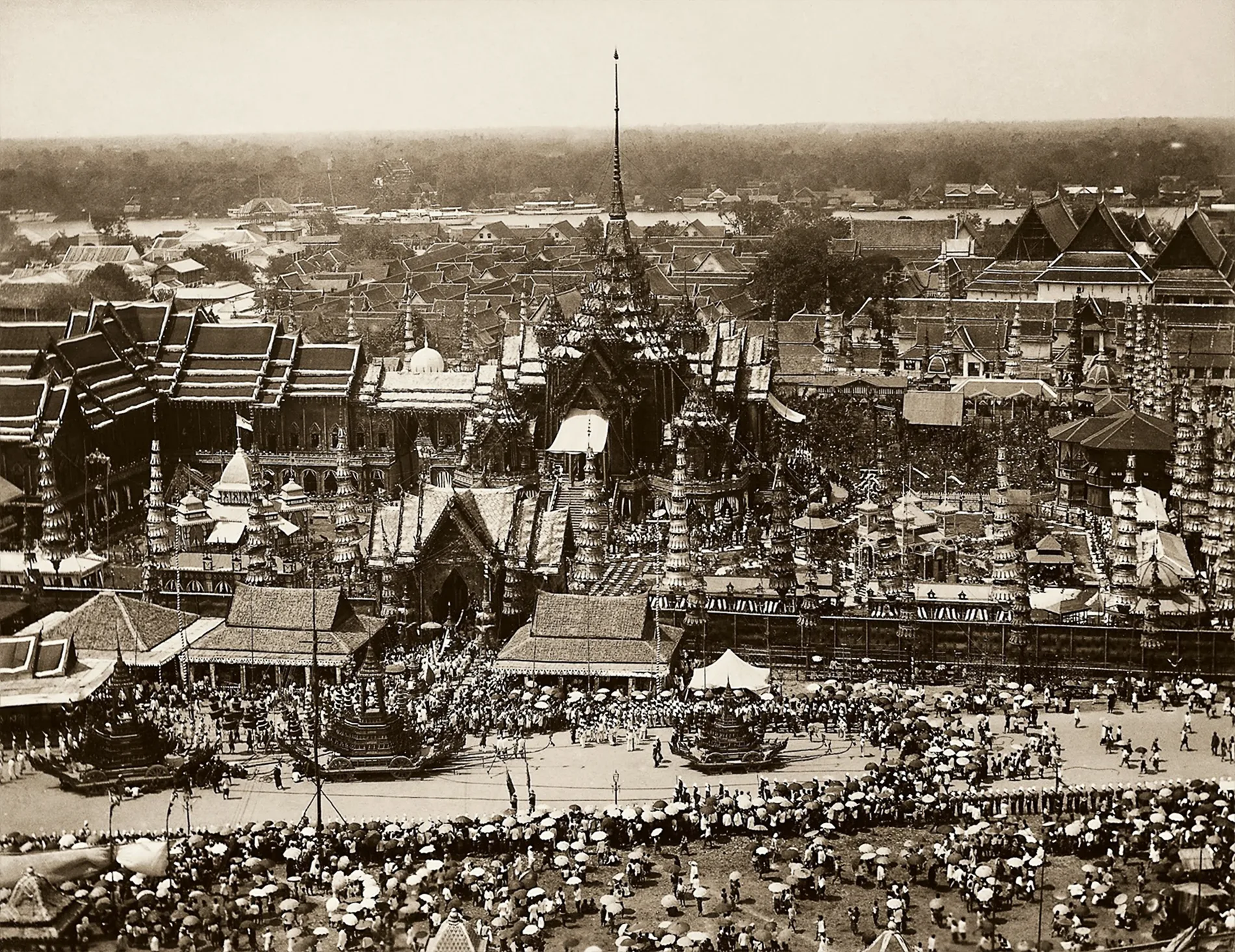
Sepia photograph of a royal cremation in Phra Nakhon District: a tall-spired crematorium, surrounded by pavilions and ornate masts, dominates the open ground where funeral chariots pass through the crowd. Beyond lie temple roofs and the river.Auteur inconnu — Wikimedia Commons, domaine public 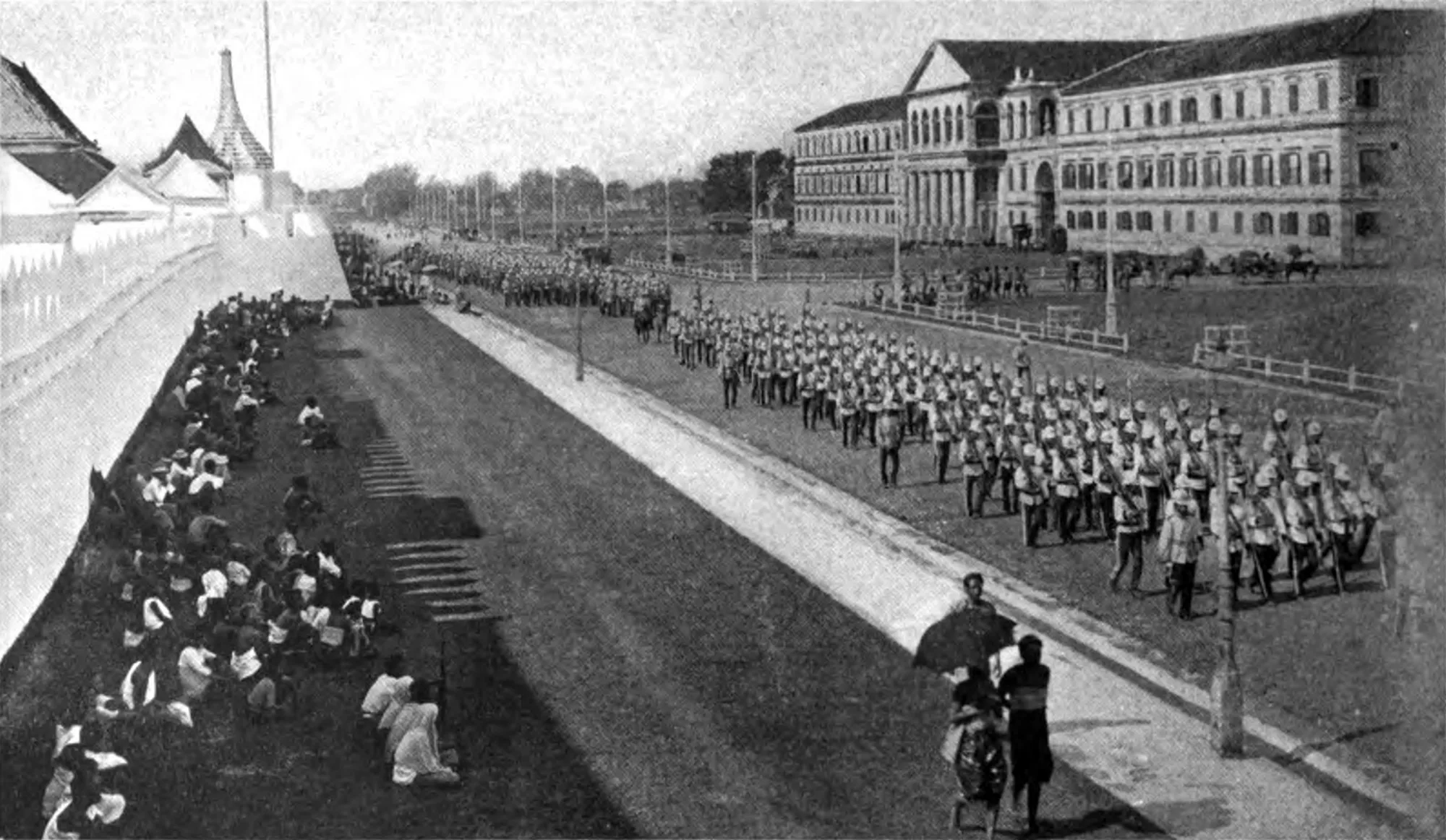
Columns of soldiers in white helmets, rifles on their shoulders, march along a wide avenue in Phra Nakhon District. On the left, seated spectators line a white wall topped by Thai roofs; on the right stands a large neoclassical building.G. P. Putnam's Sons — Wikimedia Commons, domaine public 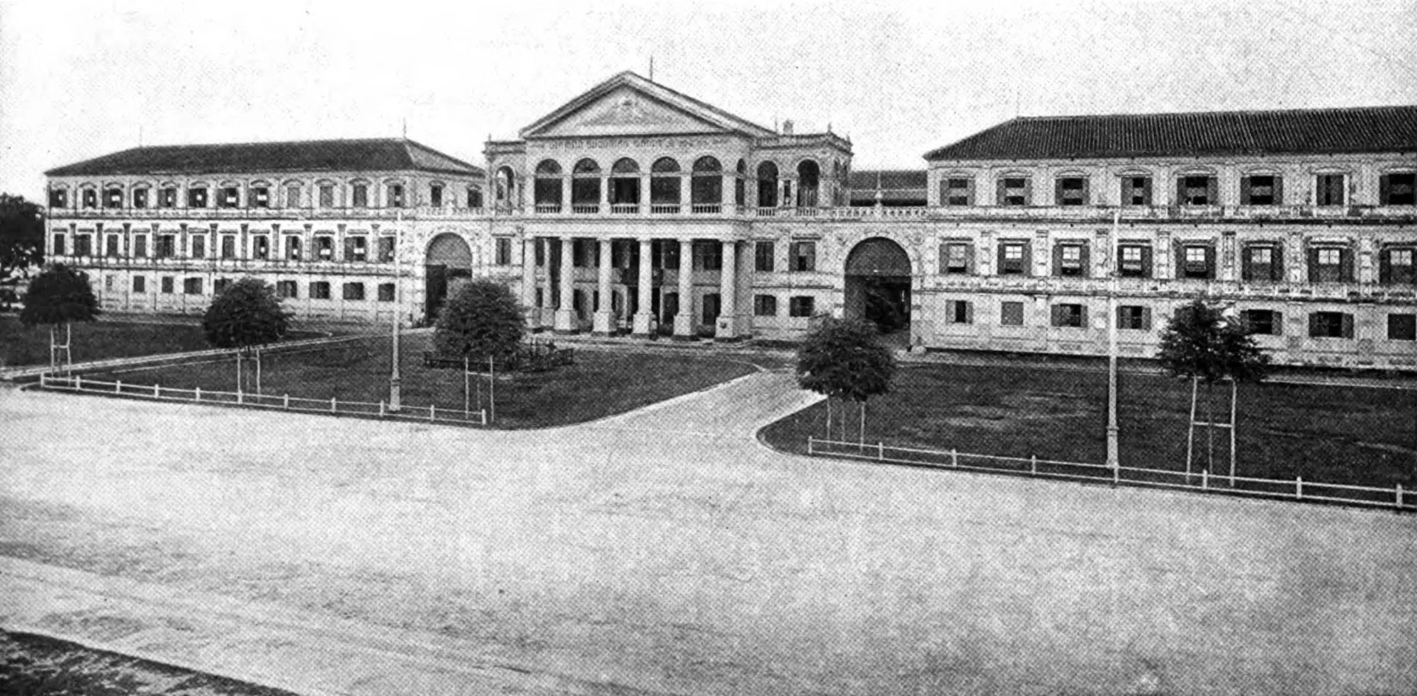
Old black-and-white photograph of a large European-style building in Phra Nakhon District: a columned portico beneath a pediment, an arcaded gallery, hipped-roof wings and arched gateways, set behind lawns planted with young trees.G. P. Putnam's Sons — Wikimedia Commons, domaine public 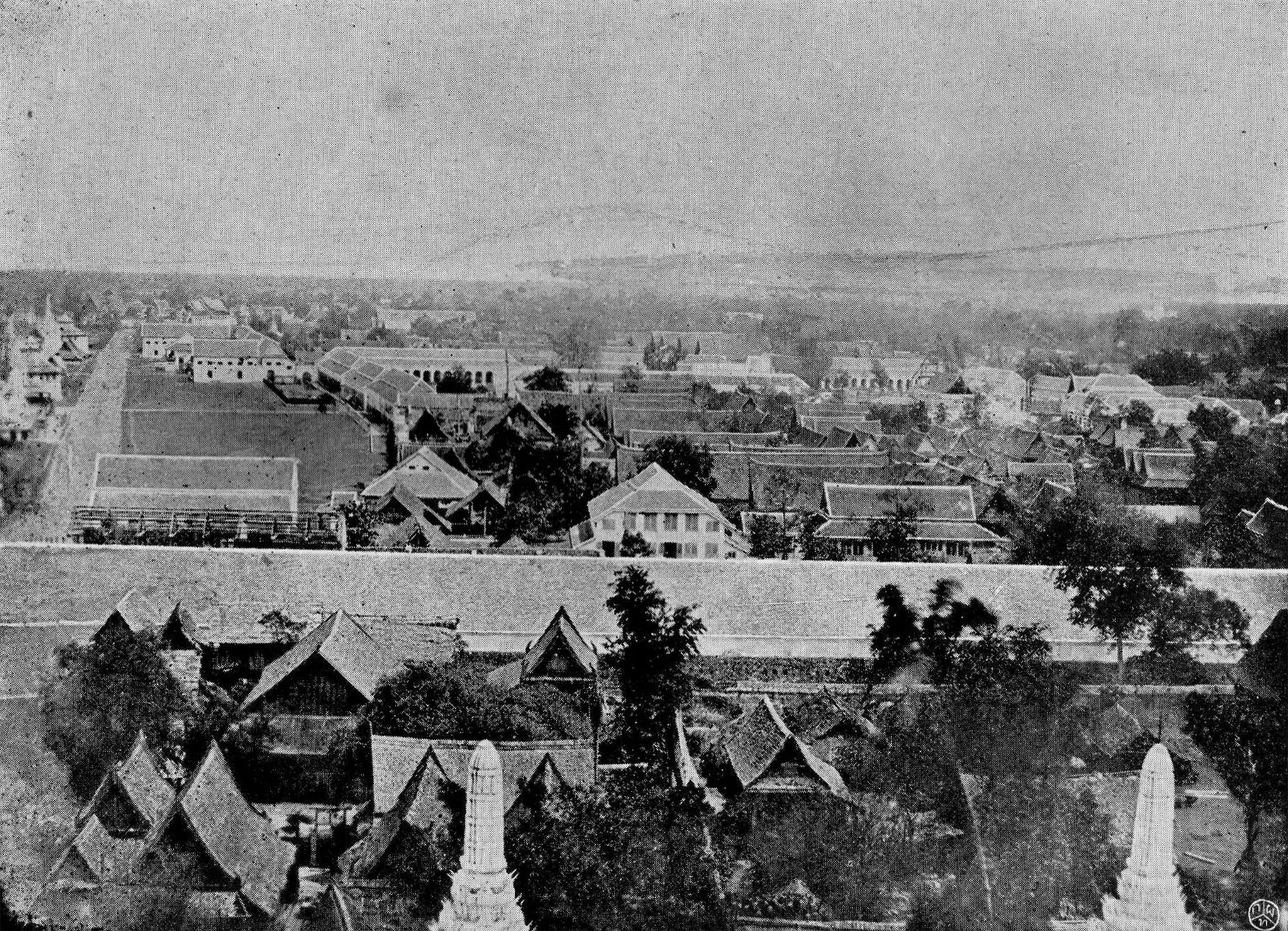
Early photograph of Phra Nakhon District seen from above: in the foreground, two white prang and gabled roofs; beyond a long wall, traditional rooftops, arcaded buildings and a straight avenue.Auteur inconnu — Wikimedia Commons, domaine public 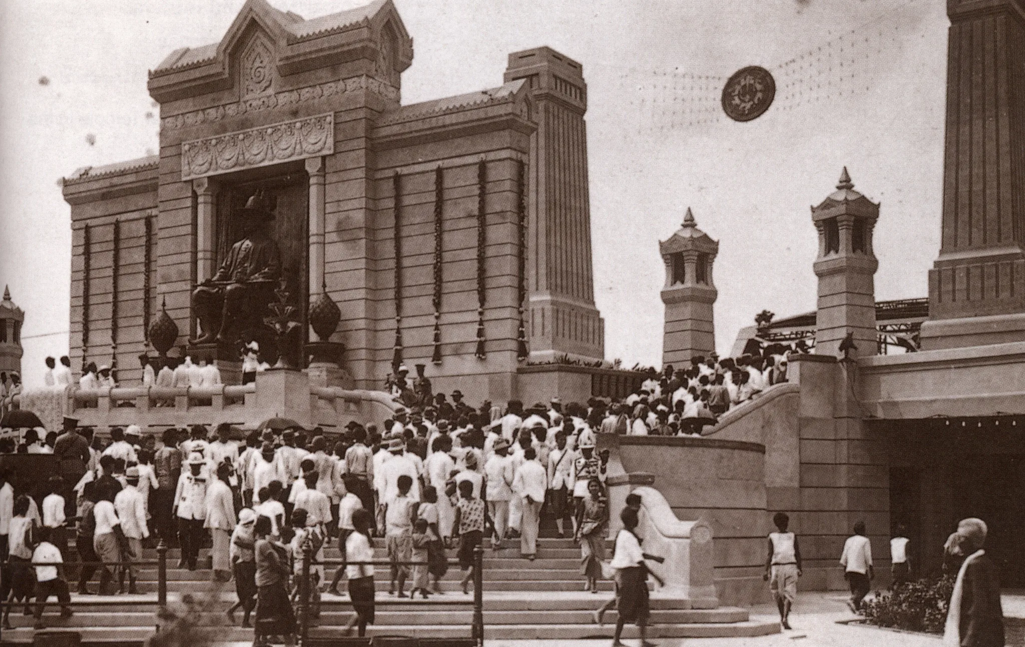
Historical photograph of Phra Nakhon District: a crowd dressed in light clothing climbs the stairs of a monument with a seated royal statue, before a garland-hung portico flanked by pylons and pavilions.Auteur inconnu — Wikimedia Commons, domaine public 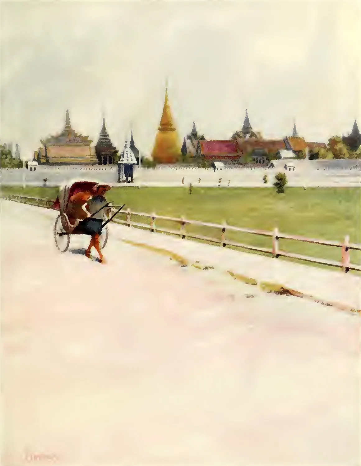
Colour illustration showing a man pulling a rickshaw beside a fence and a lawn; in the background, behind a long white wall, rise a golden chedi, spires and red roofs of Phra Nakhon District.Edwin Arthur Norbury — Wikimedia Commons, domaine public 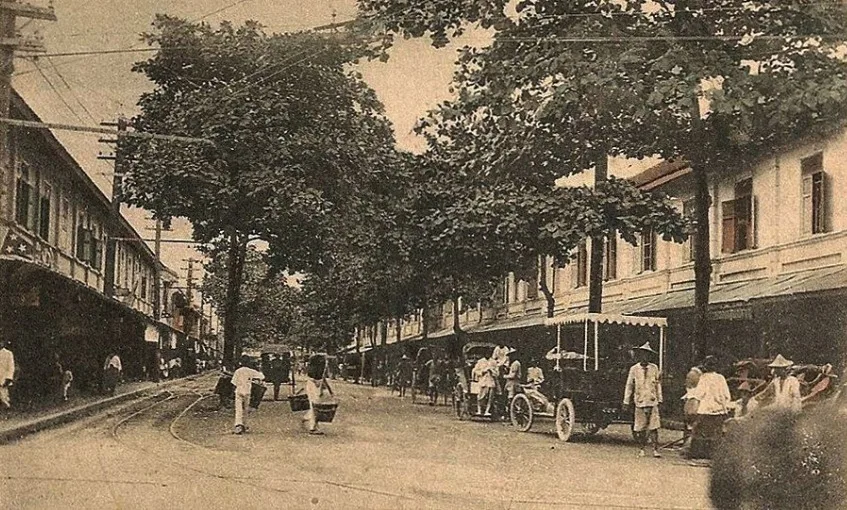
In Phra Nakhon District, a street shaded by tall trees is lined with storeyed shophouses and awnings; porters with shoulder poles, rickshaws and a canvas-roofed motor car share the roadway, which is crossed by tram rails.Auteur inconnu — Wikimedia Commons, domaine public 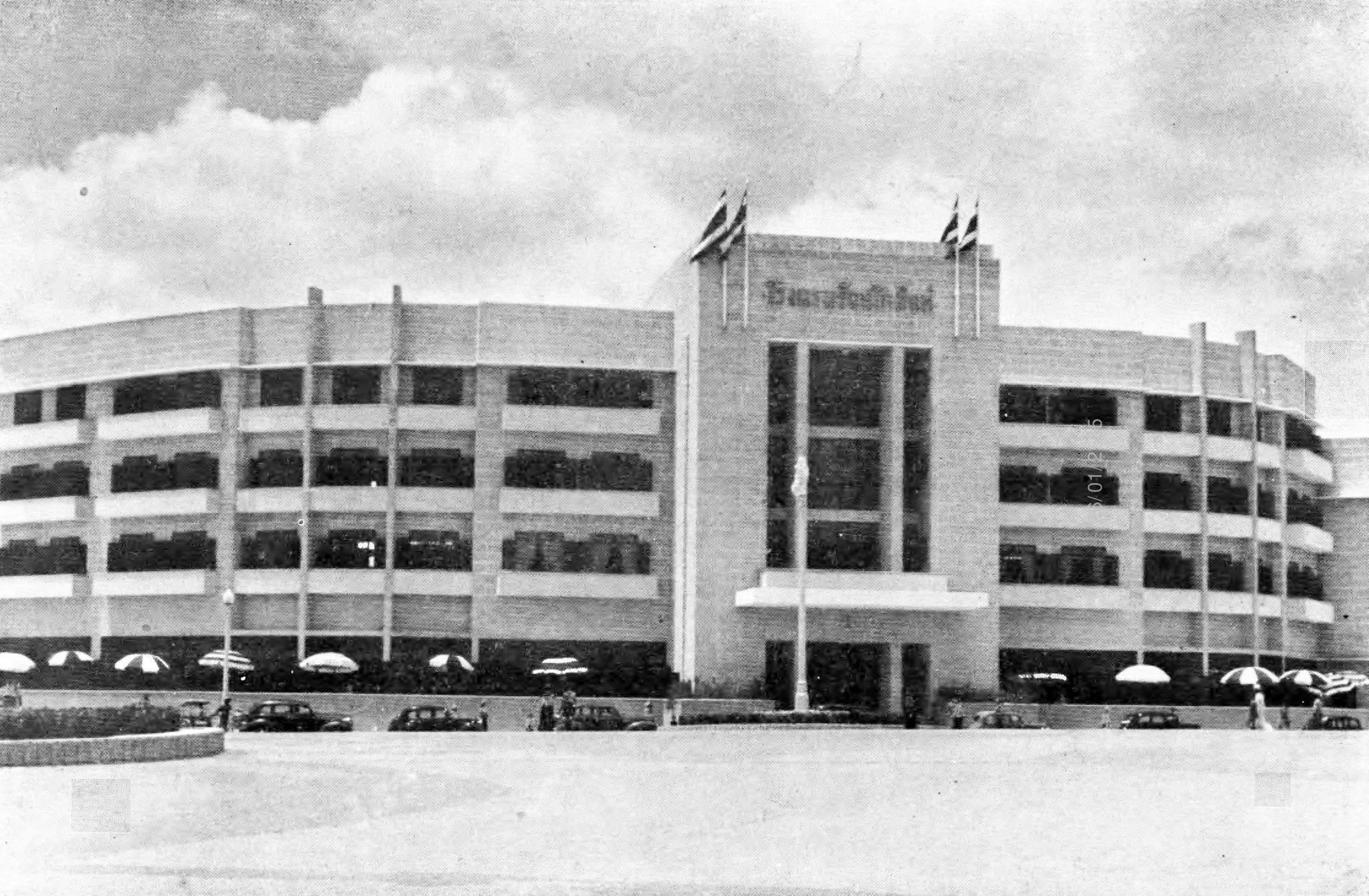
Modernist multi-storey building with horizontally banded façades in Phra Nakhon District: a central tower bearing a Thai inscription and flags overlooks an open square, with parasols and motor cars at the foot of the building.Office of the Prime Minister — Wikimedia Commons, domaine public 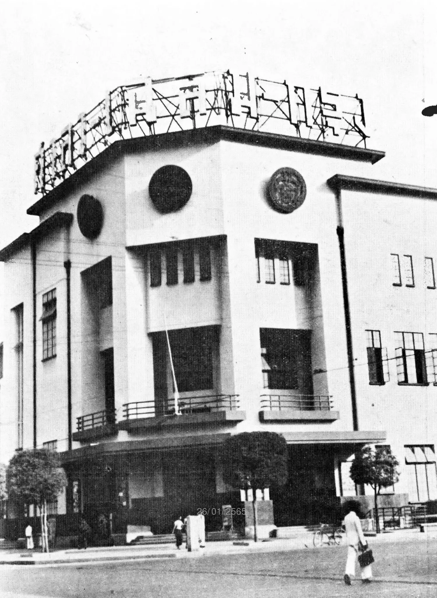
In Phra Nakhon District, a corner building with geometric volumes bears large circular medallions, balconies with metal railings and a sign in Thai characters on its roof; passers-by walk in front.Office of the Prime Minister — Wikimedia Commons, domaine public 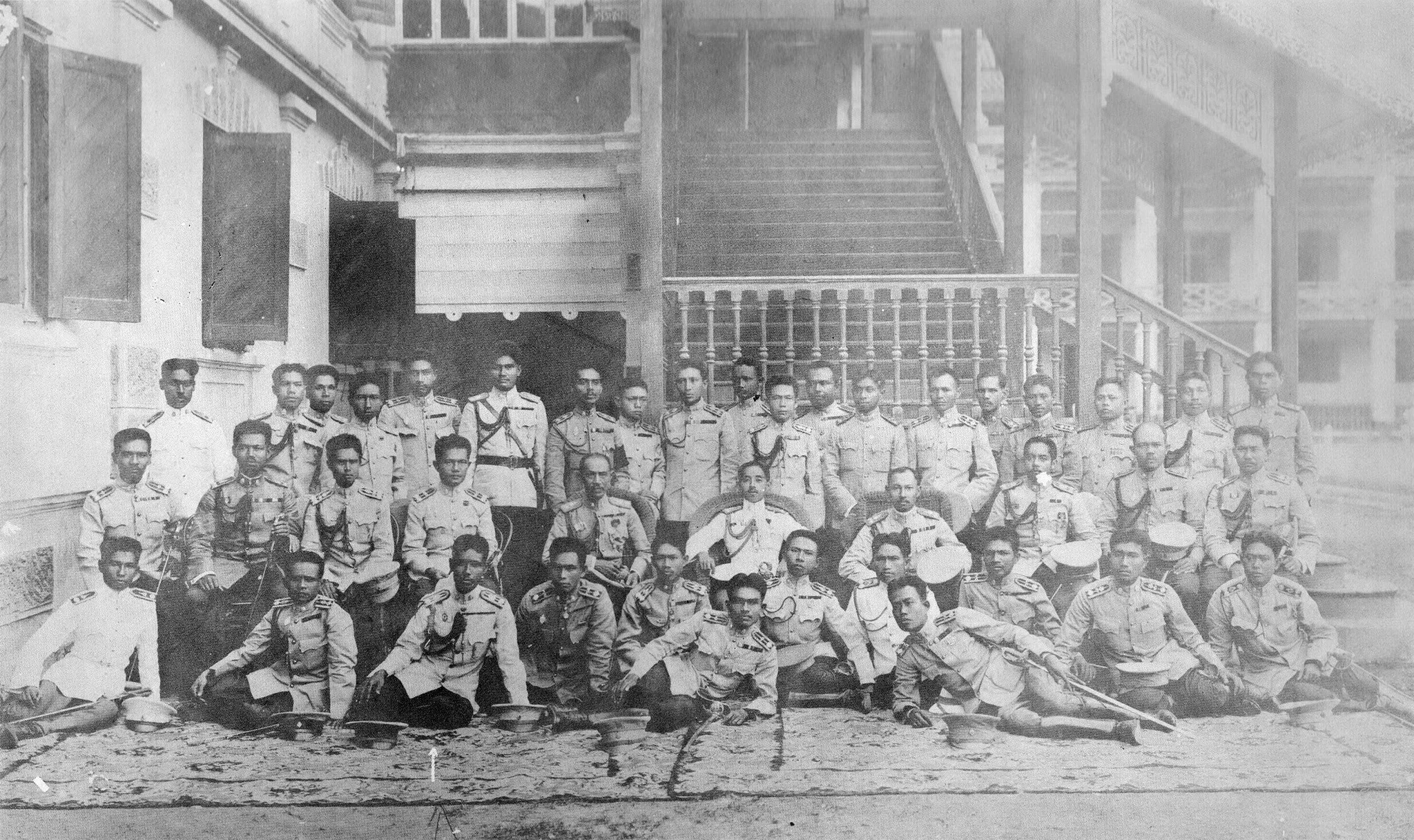
Group portrait of some forty men in light-coloured uniform, seated on chairs or on a carpet on the ground, before a building with shutters, a staircase and an ornate wooden balustrade, in Phra Nakhon District.Auteur inconnu — Wikimedia Commons, domaine public 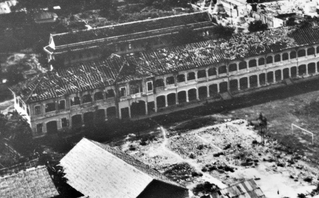
Early aerial view of Suankularb Wittayalai school, Phra Nakhon District: a curved building with two storeys of arcades, tiled roofs partly torn away, debris-strewn grounds and a football goal.Auteur inconnu — Wikimedia Commons, domaine public 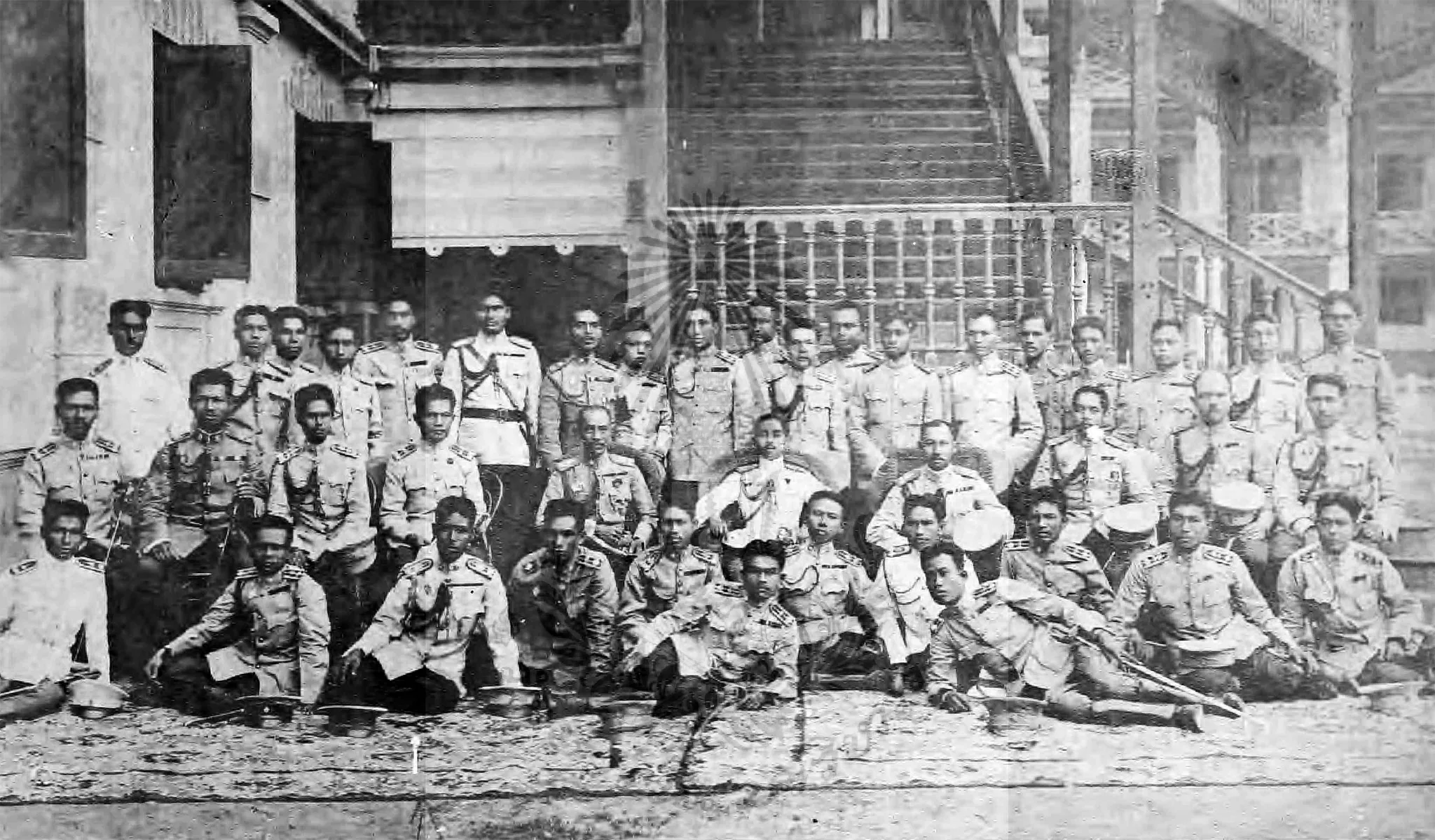
Group portrait in Phra Nakhon District: some forty men in uniforms with epaulettes, seated, kneeling or standing, pose at the foot of a wide balustraded staircase, their headgear placed on the ground before them.Auteur inconnu — Wikimedia Commons, domaine public 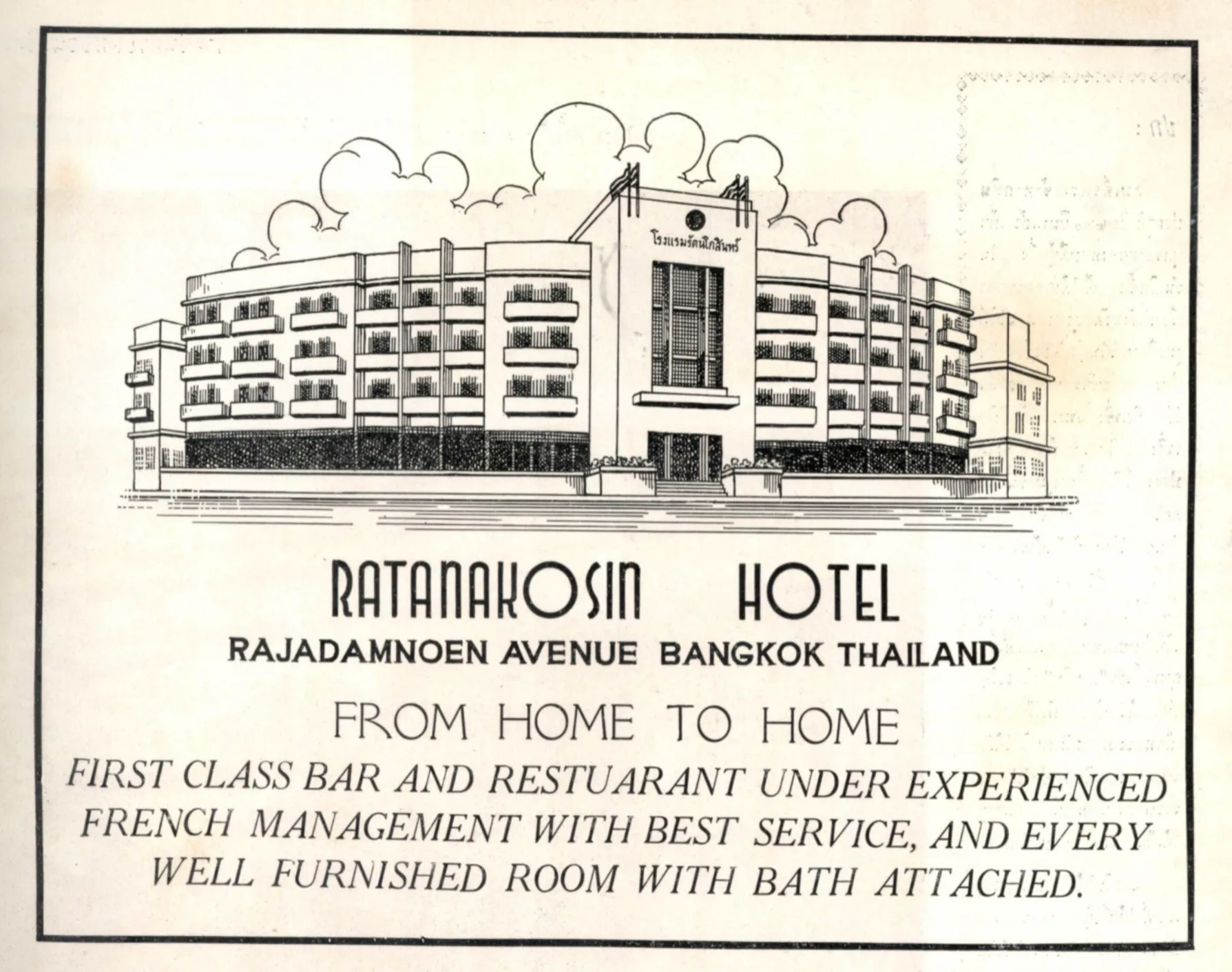
Advertisement for the Ratanakosin Hotel on Rajadamnoen Avenue, in Phra Nakhon District: a line drawing shows a modern building with a curved façade, continuous balconies and a central entrance tower bearing the hotel’s Thai name.Photography Section, Public Relations Department / Thailand Illustrated — Wikimedia Commons, domaine public 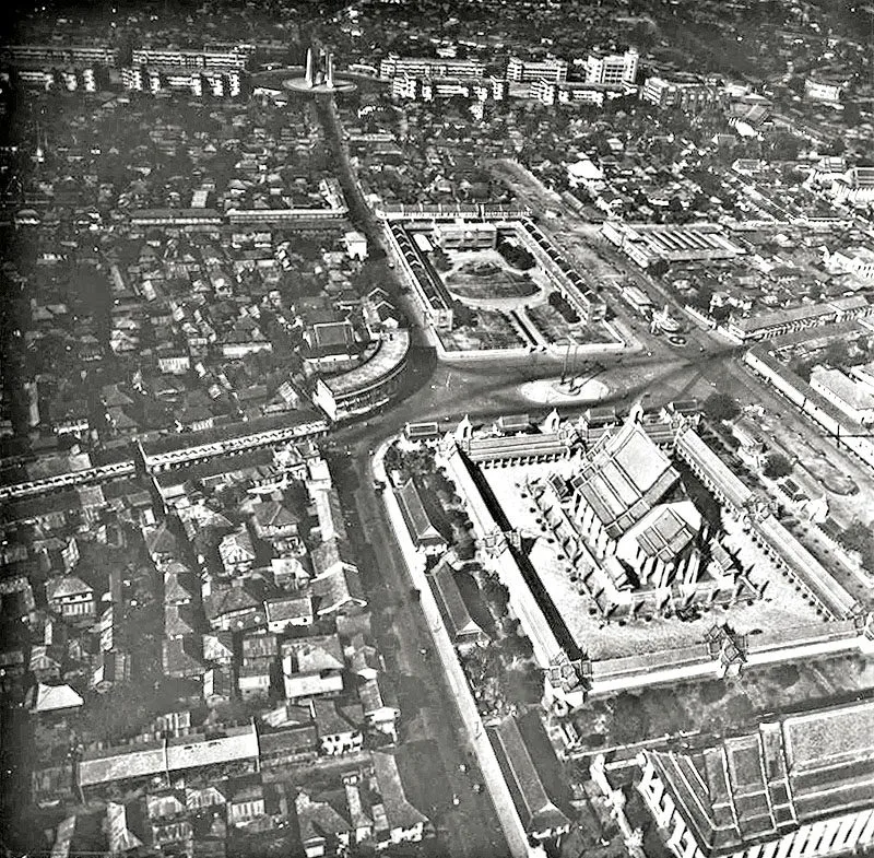
Old aerial view of Phra Nakhon District: the Giant Swing (Sao Ching Cha) stands on a circular square before a large temple compound with tiered roofs, amid a dense fabric of houses and avenues.ปีเตอร์ วิลเลียมส์ ฮันต์ นักบินฝ่ายสัมพันธมิตร — Wikimedia Commons, domaine public 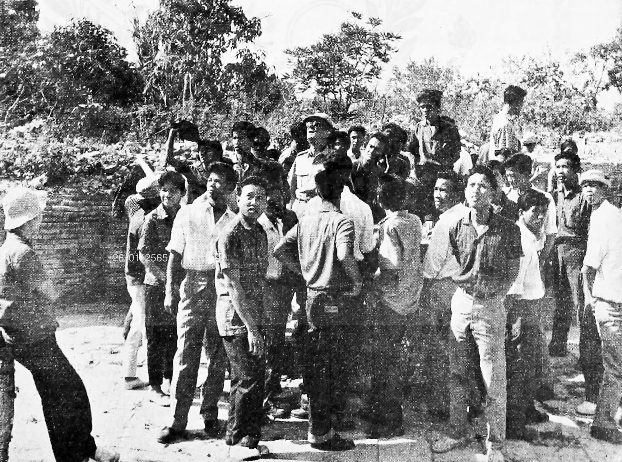
Old black-and-white photograph reproduced from a printed page: a crowd of men, some in uniform and helmets, stands before a brick wall topped by trees, in Phra Nakhon District.Auteur inconnu — Wikimedia Commons, domaine public 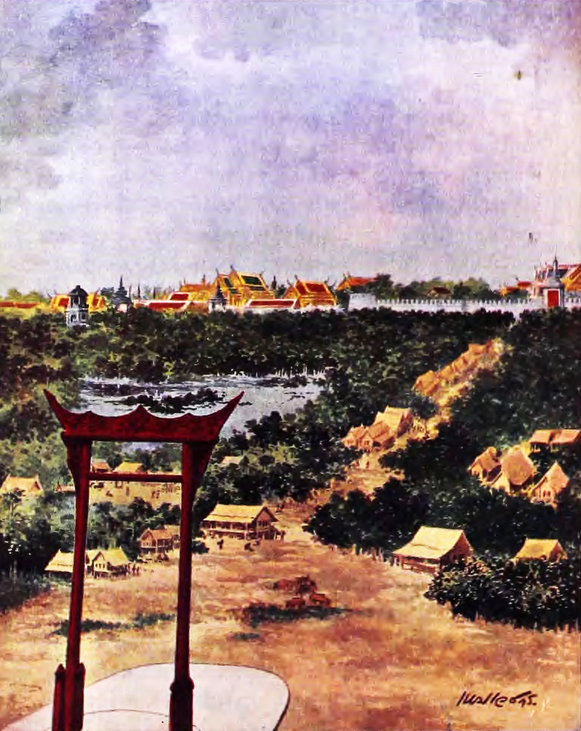
Painting of Phra Nakhon District: a tall red portal stands over open ground lined with thatched wooden houses, while in the distance the red and gold roofs of temples rise behind a long white crenellated wall.Hem Vejakorn — Wikimedia Commons, domaine public 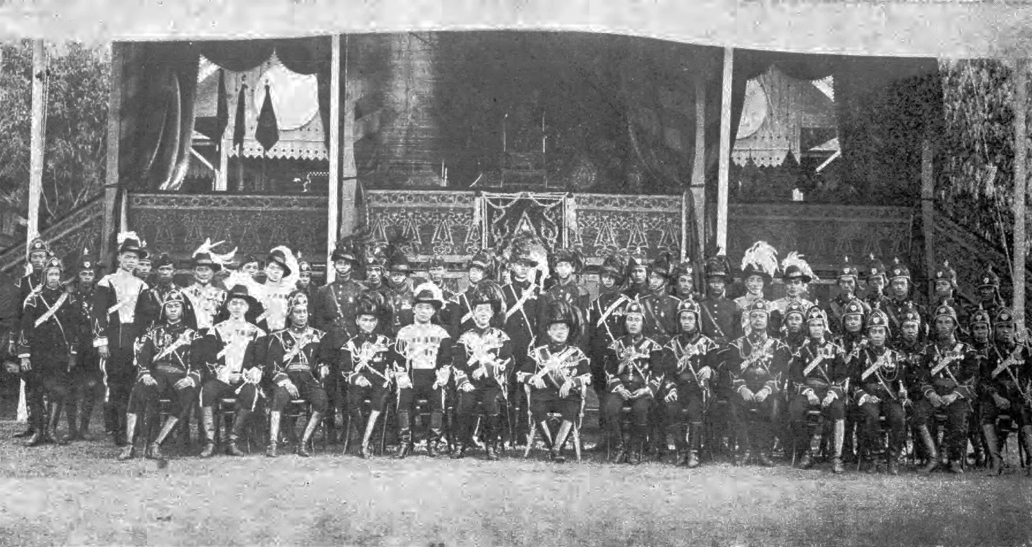
In Phra Nakhon District, several dozen men in ceremonial uniforms and plumed helmets pose in two rows before a pavilion hung with drapery and adorned with decorated panels.Auteur inconnu — Wikimedia Commons, domaine public