
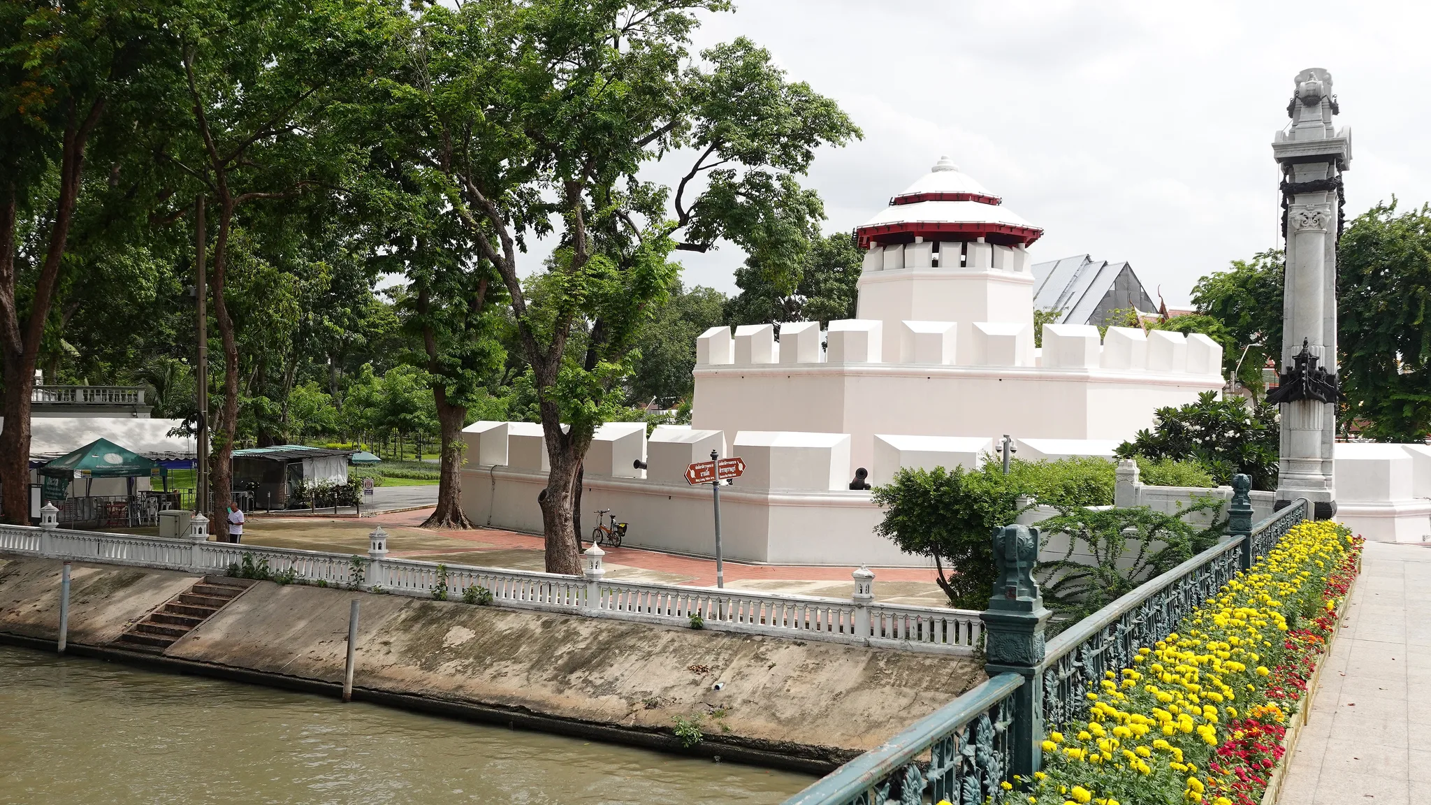
 Mahakan Fort, a white fortification with massive merlons crowned by an octagonal turret with a red roof, stands beside a canal lined with a balustrade, amid tall trees and beds of yellow and red flowers.© Eric Monteil
- Destination
- Bangkok (Phra Nakhon)
- Heritage Family
- History, kingdoms and the making of Siam
- Typology
- Fortification & defensive work
- Visit
- Available tours →
Mahakan Fort is one of the defensive works raised around Bangkok when King Rama I, founder of the Chakri dynasty, made the city his capital. Together with Phra Sumen Fort, it is one of only two survivors of a city wall that once had fourteen, and it still keeps beside it a stretch of the original rampart. Protected as an ancient monument since the mid-twentieth century, it also sheltered in its shadow a community of residents whose eviction, completed in 2018, made the site a landmark in Thai debates on living heritage. A small, whitewashed octagonal fort, it now stands at the centre of a public park.20
Key facts
- Destination
- Bangkok
- Heritage Family
- History, kingdoms and the making of Siam
- Typology
- Fortification & defensive work
- Places
- Khlong Rop Krung
- Phra Nakhon
- Periods
- People
- Rama Ier
- Communities
- Pom Mahakan community
- Events
- Construction
- Eviction of the Pom Mahakan community
- Registration as a national ancient monument
- Opening public park
- Heritage
- —
- Glossary
- Khlong
- Ancient monument
- Royal Gazette
- Spirit shrine
- Banyan
- Rattanakosin period
- Keywords
- —
- Date
- —
- Collections
- —
Practical info
Practical information about this site is taken from its Google Maps page. We advise you to check it before visiting.
- Address
- QG44+66R, Maha Chai Rd, Khwaeng Wat Bowon Niwet, Khet Phra Nakhon, Krung Thep Maha Nakhon 10200
A rampart for the new capital
Rama I’s royal city
In 1782, General Chakri became king as Rama I (1737–1809) and founded the dynasty that bears his name. To give shape to his capital, Phra Nakhon, the royal city that would become the historic heart of Bangkok, he had moats dug, a city wall raised and the Grand Palace built. The following year, in 1783, a series of forts was constructed at regular intervals along this rampart. Mahakan Fort was one of them: it stands midway along the eastern side of the wall, facing the canal that borders the city. Its purpose was military. The aim was to protect the new capital according to the defensive thinking then current in Siam, with a continuous wall punctuated by works able to hold artillery and men on guard.20
A rampart made of past capitals
This city wall did not arise from nothing. It is said to have been built with materials salvaged from the walls of the city of King Taksin (1734–1782), the ruler of Thonburi who preceded Rama I, from the ruins of an old fort raised under King Narai (1632–1688), and from the remains of the fortifications of Ayutthaya, the kingdom’s former capital. Bangkok’s rampart would thus bear, in its very fabric, the trace of the capitals that came before it.18
Fourteen forts, two survivors
The whole formed a considerable work for its time: a city wall some seven kilometres long, pierced by numerous gates and reinforced by fourteen forts. Starting from the north and moving clockwise, Mahakan Fort came fourth, after the Phra Sumen, Yukhonthon and Maha Prap forts. It stands on the bank of Khlong Rop Krung, the canal (khlong) that encircles the old city, near the end of Phan Fa Lilat Bridge. Over time, the city spread far beyond its walls, and almost the entire city wall has disappeared. Of the fourteen forts, only Mahakan and Phra Sumen survive today, making this fragment of rampart one of the few visible witnesses to the capital’s original layout.20
Whether the fort was attached to one of the city’s palaces remains an open question. No princely palace stood nearby, and the fort was probably dependent on another residence.18
Reading the fort and its rampart
An octagonal fort
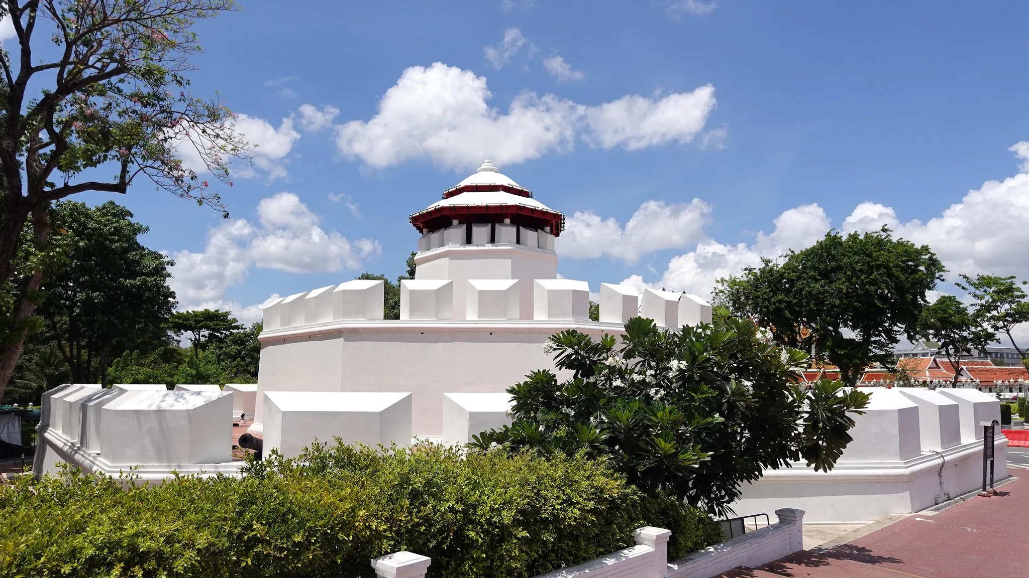
On site, the fort appears as a compact, whitewashed building on an octagonal plan. It rises over three levels to a guard post, with cannon set on the thick outer wall. What can be seen today is also the result of recent interventions, notably the paintwork and lighting installed when the park was laid out in 2018.24
The wall of the royal city
The fort cannot be understood on its own. A stretch of the city wall is joined to it and continues along Maha Chai Road. Between the canal outside and the royal city within, this wall still marks the boundary of Phra Nakhon as Rama I had drawn it. The fort was a strongpoint on this line, from which the canal and its surroundings were watched. Indeed, it is the whole ensemble, not the fort in isolation, that has been protected: the monument is designated as Mahakan Fort with its ramparts.18
This reading of the ensemble has a wider significance. It makes the site not a single, isolated building but a piece of Bangkok’s founding urban structure, the one that separated the royal city from its outskirts. The space between the fort and the wall, long inhabited, has been at the heart of the site’s recent history.
From military work to protected monument
A property to let
Once the military threat had receded and the city had spread beyond its walls, the fort lost its original function. An episode from 1938 shows how it was then regarded. The mayor of the Bangkok municipality informed the Fine Arts Department that someone wished to rent the fort and undertook to build nothing on it. The Fine Arts Department gave its consent: in its view, the fort was not a place of worship, and the tenant’s promise of upkeep guaranteed that it would not be damaged. The lease does not appear to have gone ahead. Above all, the episode reveals that at the end of the 1930s the structure was regarded more as an available property than as a monument to be preserved.1
Ancient monument in 1949
Attitudes changed after the Second World War. On 22 November 1949, the Fine Arts Department registered Mahakan Fort and the city wall as a national ancient monument (boran sathan, a category that places a building under state protection), by publication in the Royal Gazette. Ten years later, in 1959, the historian Chusri Sathorn devoted an article to the fort in the journal Silpakorn, a publication of the Fine Arts Department. The fort thus became an object of study and conservation in its own right.17
The park envisaged in 1959
That same year, 1959, saw the start of planning for the historic district of Rattanakosin, the old heart of the capital founded by Rama I. The programme had three aims: to recapture the atmosphere of Bangkok under King Rama V (1853–1910), to reduce the area’s population and to create green spaces opening up views of the monuments. Mahakan Fort featured in it as a future small public park, within a project to conserve the city wall and fortifications that formed part of the Rattanakosin master plan. The idea of a garden at the foot of the fort thus predates by several decades the conflict through which it would be realised. It carried within it a conception of heritage centred on the monument and its visual enhancement, in which the site’s residents had no planned place.18
A community between the fort and the rampart
A disputed antiquity
In the narrow space between the fort and the city wall, a community had settled, known as Pom Mahakan. Its origins are the subject of conflicting accounts, and this disagreement weighed heavily in the site’s history. The residents themselves traced their presence back to the reign of King Rama III (1788–1851): servants of aristocratic families are said to have settled there to live near their masters. This account, often repeated, belongs to the residents’ own claims.19
Other voices place this origin earlier or later. According to some historians and conservationists, the community was present from the founding of the fort. Parinya Thewanaruemitkul, vice-rector of Thammasat University, saw it as a community that had been alive since the beginning of the Rattanakosin period. Other accounts date its emergence to the late nineteenth century or speak of more than a century of existence.13
Conversely, Sakchai Boonma, then director of the land acquisition division of the Bangkok Metropolitan Administration, disputed the authenticity claimed by the community. The question of antiquity was therefore not merely historical: it served as an argument for each side, for some to ground a right to stay, for others to deny it. The date at which the community settled remains unknown.3
A neighbourhood of wooden houses
On the eve of its eviction, the community numbered some three hundred residents, spread across more than fifty households, some of which claimed six generations of presence. Their surroundings consisted mainly of wooden houses, some of which were described as a century old. One of them had a less steeply pitched roof and short eaves, a Western-influenced feature characteristic of the Rama V period. The oldest of all, known as the “Ancient House”, belonged to the family of the lawyer Pod Uppatateerawat, one of the site’s defenders.9
This neighbourhood was not merely a group of buildings. Traditional musical instruments and birdcages were made there, and spirit houses, small shrines dedicated to the guardian spirits of the place, sheltered at the foot of banyan trees held to be sacred. The residents had also put up at the door of each house a sign telling its story, which earned the place the nickname “living heritage museum”. Through this gesture, the community presented itself as part of the site’s heritage, alongside the fort and the rampart.4
More than a quarter of a century of conflict
Expropriation and excavations
The conflict took legal form in 1992, when a royal expropriation decree was issued in favour of the Bangkok Metropolitan Administration, which from then on claimed the land to create the long-planned park. In 2004, the Administrative Court upheld its right to demolish the houses. During these same years, the ground beneath the site was examined several times. In 1998, the Fine Arts Department studied the location of a wastewater treatment plant planned for the garden behind the fort, a few metres from it, and warned of a risk of cracking and subsidence of the structure. An archaeological test pit followed in 1999, then an excavation in 2004, carried out by the company Moradok Lok with the Fine Arts Department, ahead of works planned by the Armed Forces Development Command on the fort and the park.14
The living museum project
Another path was nevertheless explored. Around 2006, the Governor of Bangkok, Apirak Kosayodhin, approved a “living museum” project, studied by Silpakorn University, which envisaged restoring the old houses with the involvement of the residents. A land-sharing plan had been drawn up with the architect Chatri Prakitnonthakan, of the same university. Later, a committee bringing together four parties in turn recognised the historical value of the community and its wooden architecture, and recommended conservation with the participation of the residents. The Bangkok Metropolitan Administration rejected this solution. The community, for its part, had never enjoyed any protection: the notion of a community worthy of conservation did not exist in heritage law when the fort was registered.16
The eviction, 2016–2018
The outcome unfolded over two years. On 28 March 2016, the Bangkok Metropolitan Administration posted an eviction order, and houses were demolished in the months that followed. Led by their former representative, Thawatchai Woramahakhun, the last residents eventually agreed to leave. On 22 April 2018, they held a farewell ceremony, “Farewell Mahakan”. The deadline set for vacating the site was 25 April; seven to ten families were still there at that point. The “Ancient House” was then dismantled, and its components were kept by its owner. Most of the wooden houses thus disappeared between 2016 and 2018.6
An international echo
The affair reached beyond the local sphere. The International Alliance of Inhabitants, a network campaigning for the right to housing, denounced the eviction as contrary to the International Covenant on Economic, Social and Cultural Rights. The Siam Society, a learned society devoted to the cultures of Thailand, organised a conference on the disappearance of the community and on the question of cultural rights. These stances made Mahakan Fort a frequently cited example of the tension between protecting a monument and protecting a way of life.22
The public park and its critics
Building the park
Once the land had been cleared, the Bangkok Metropolitan Administration committed funds in May 2018 to repair the collapsed sections of the wall and the fort and to deal with the wastewater left by the former community. It also opened discussions with the Fine Arts Department on the conservation and restoration of the fort. Work on the park, meanwhile, moved quickly: the ground was raised by several tens of centimetres to install drainage and lighting, and signage in Thai, English and Mandarin was put up.7
The opening in 2018
The park opened to the public on 24 July 2018, under Governor Aswin Kwanmuang. Across just over half a hectare, a central lawn crossed by paths stretches between mature trees, surrounded by panels recounting the history of the fort and of the Rattanakosin district. The 1959 project was thus realised: the fort and the rampart are cleared and laid open to view from a green space. Yet this clearance also erases the state of the site that several generations had known.10
A contested park
The reception was harsh. From the opening, internet users criticised the park for its lack of historical relevance. The park was later judged a failure: very little visited, it was criticised for the glaring white of the repainted fort and its neon-coloured lighting. Sakchai Boonma, by then Deputy Governor, subsequently proposed turning the area into a “miniature city museum”, a sign that the site’s purpose has not found a definitive form. Mahakan Fort thus remains a protected monument whose contemporary use is still under debate.11
Understanding
Mahakan Fort is more than a military relic: with its stretch of rampart, it preserves one of the last visible traces of the royal city laid out by Rama I, at a time when Bangkok was becoming a capital. Protected since 1949, it long coexisted with a community settled at its foot, which claimed a long-standing presence, wooden houses, crafts and places of worship. The site thus brought together two heritages, one of stone and recognised by law, the other living and devoid of any status. The eviction completed in 2018 and the opening of a park settled the matter in favour of the former, in line with a project conceived as early as 1959. The criticism levelled at this park, judged little visited and poor in historical meaning, and the projects that have followed one another since, show that the site’s purpose remains uncertain. The debate on cultural rights it has prompted reaches far beyond Bangkok. Does a monument cleared of the life that surrounded it still tell the story of the city, or only that of its walls?
Rattanakosin, from the royal citadel of 1782 to the historic districts that shaped contemporary Bangkok.
- Khlong
- Canal or waterway, natural or man-made, which long played a major role in transport, irrigation and the organisation of settlements and territories in Thailand.
- Ancient monument
- In Thailand, a legal category (boran sathan) that places a building or site under State protection as heritage.
- Royal Gazette
- Official journal of the Kingdom of Thailand, in which laws, decrees and official acts are published, including the listing of protected monuments.
- Spirit shrine
- Small shrine dedicated to the guardian spirits of a place, where offerings are made.
- Banyan
- Tropical fig tree whose aerial roots form new trunks; it is often regarded as sacred in Asia.
- Rattanakosin period
- Period of Thai history that began with the founding of Bangkok as the capital by King Rama I at the end of the eighteenth century. It takes its name from Rattanakosin Island, the heart of the royal city.
Primary sources
Studies
- 3Mahakan eviction still looms large, Bangkok Post ↗
- 4Pom Mahakan eviction would be a calamitous loss, Bangkok Post ↗
- 5The Mahakan Fort mistake, Bangkok Post ↗
- 6Pom Mahakan community concedes: eviction to go ahead, Prachatai English, 2018 ↗
- 7Bangkok Budgets 69M to Renew Pom Mahakan, Khaosod English, 2018 ↗
- 8End of an era: Pom Mahakan residents face eviction as fort to be turned into public park, Coconuts Bangkok, 2016 ↗
- 9History Lost: The end of the centuries-old Mahakan Fort community (PHOTOS), Coconuts Bangkok, 2018 ↗
- 10Bangkok's Mahakan Fort reopens today as public park, Coconuts Bangkok, 2018 ↗
- 11Bangkokians are taking to social media to burn the new Mahakan Fort park, BK Magazine, 2018 ↗
- 12Mahakan Fort park to be ready in mid-June, Pattaya Mail ↗
- 13Folk history, culture at risk unless officials learn from Mahakan Fort fiasco: academics, The Nation (Thailand) ↗
- 14ปิดตำนานการต่อสู้ 26 ปี ของชุมชนป้อมมหากาฬ สิ้นชุมชน สิ้นประวัติศาสตร์ทางกายภาพ, The Standard ↗
- 15ปิดตำนาน "ชุมชนป้อมมหากาฬ" ขีดเส้นรื้อทุกหลัง 29 เม.ย.นี้, Thai PBS ↗
- 16ชุมชนป้อมมหากาฬ: พื้นที่ประวัติศาสตร์ที่ยังมีลมหายใจ กับภาพสะท้อนความล้าหลังของกฎหมายไทย, The Momentum ↗
- 17ชูศรี สาธร, ป้อมมหากาฬ, นิตยสารศิลปากร, ปีที่ 3 ฉบับที่ 3, 1959
Reference works
- 18ป้อมมหากาฬและกำแพงเมือง, ศูนย์ข้อมูลเกาะรัตนโกสินทร์, หอสมุดสาขาวังท่าพระ, มหาวิทยาลัยศิลปากร ↗
- 19ชุมชนป้อมมหากาฬ, ศูนย์ข้อมูลเกาะรัตนโกสินทร์, หอสมุดสาขาวังท่าพระ, มหาวิทยาลัยศิลปากร ↗
- 20Fortifications of Bangkok, Wikipedia ↗
- 21Phra Sumen Road, Wikipedia ↗
- 22Rendered Invisible: Pom Mahakan, Bangkok, and Cultural Rights, The Siam Society ↗
- 23Zero Evictions for Pom Mahakan, International Alliance of Inhabitants ↗
- 24Mahakan Fort, Lonely Planet ↗
- 25Mahakan Fort — Heritage under threat, Travelfish ↗
Further reading
Architecture and decoration
Explore the heritage
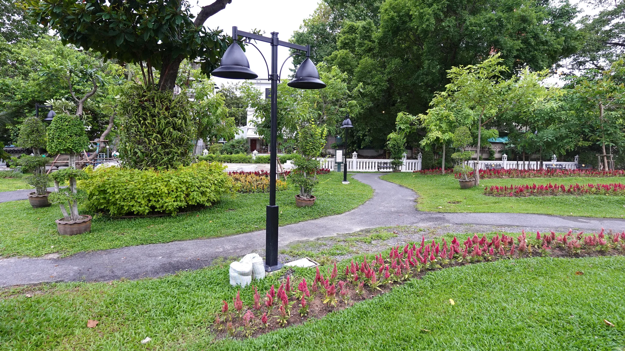
Landscaped green space at Mahakan Fort: a tarmac path winds between lawns edged with beds of celosia, pruned trees in pots and black lamp posts, in front of a white balustrade shaded by tall trees.© Eric Monteil 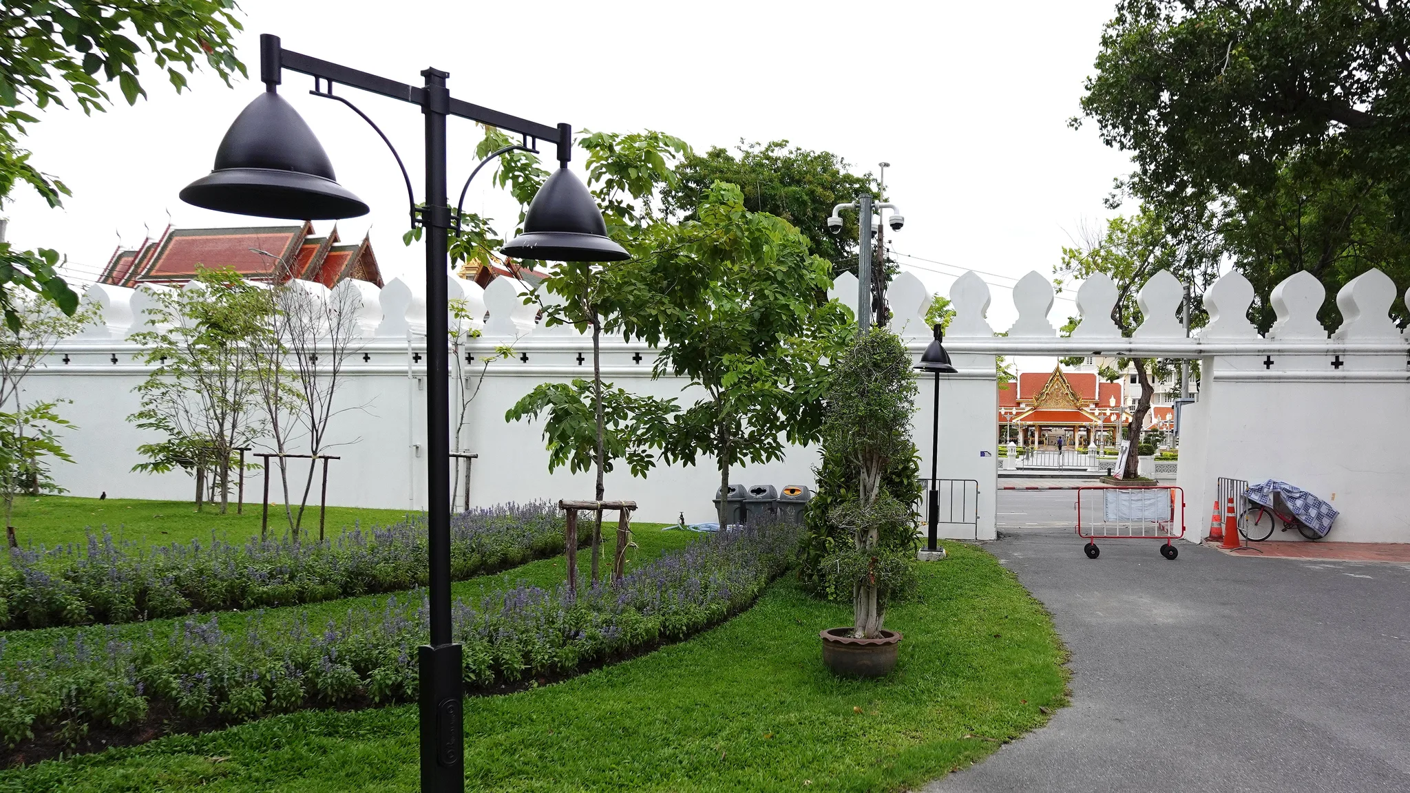
At Mahakan Fort, a landscaped garden of lawns and flower beds runs along the white enclosure wall with rounded merlons; through the opening in the wall, a roadway and a pavilion with tiered roofs can be seen.© Eric Monteil
Archive
Memory of time passing
Historical images preserve the visual memory of places and of the ways they have changed.
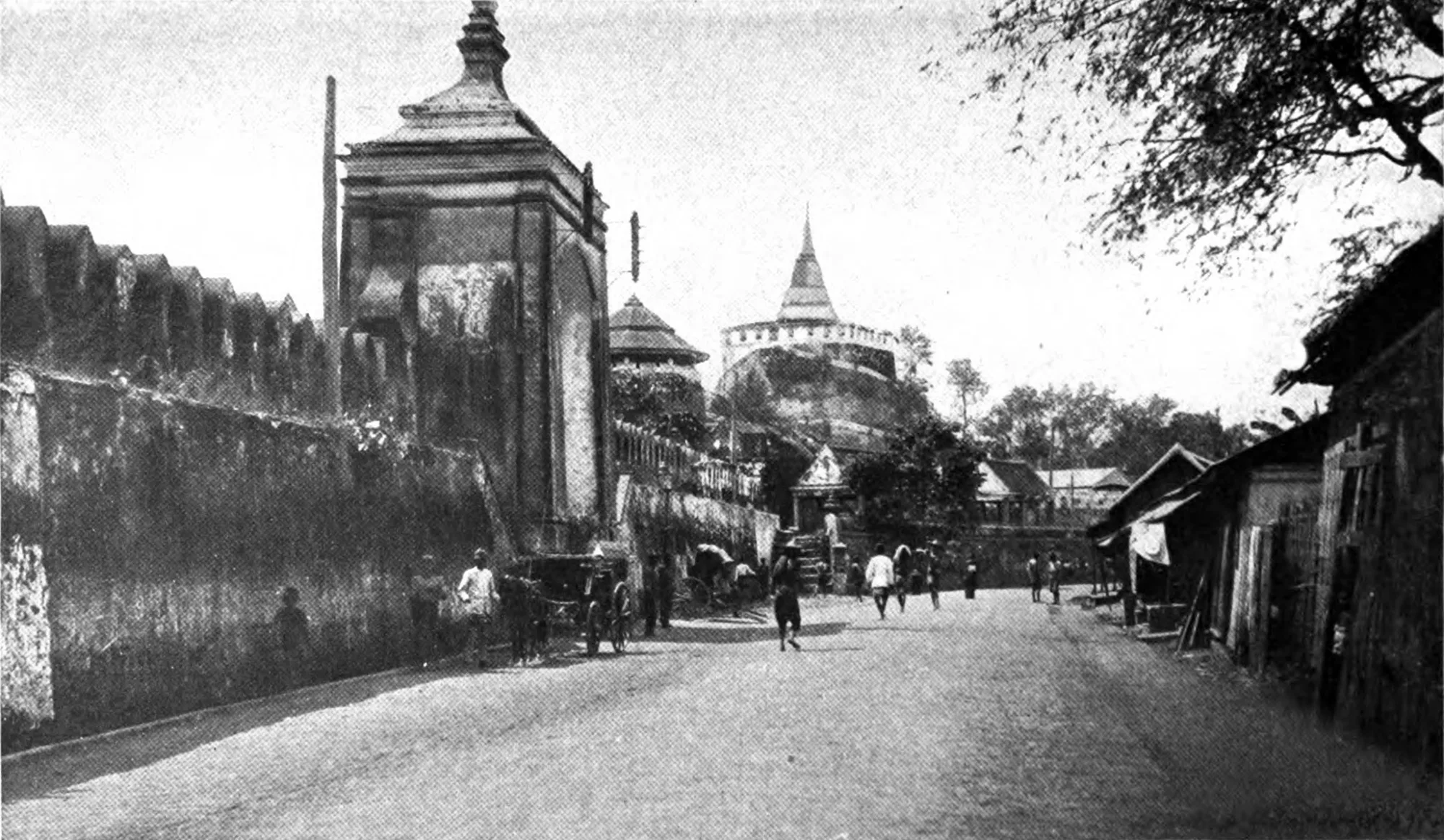
A street with passers-by and rickshaws along the crenellated rampart of Mahakan Fort, marked by a gate with a pyramidal roof and a tower with a tiered roof; in the background, a hill bears a chedi, opposite wooden houses.G. P. Putnam's Sons — Wikimedia Commons, domaine public